
Summary:
As of the latest advisory, Hurricane Willa intensified to a category 5 hurricane in the Eastern Pacific ocean, headed for the coastline of Mexico. Landfall is expected on Tuesday along the border of the states of Nayarit in the south and Sinaloa in the North. Similar to other storms of the season, Willa has undergone a period of rapid intensification, with maximum sustained winds increasing by 120 mph over the past 48 hours. Current intensity estimates put maximum sustained winds at 160 mph, which is stronger than Hurricane Michael when it made landfall earlier this month in Florida. Not only is the storm notable, but the entire Eastern Pacific basin is in the midst of a very active hurricane season; by some measures the most active on record.
Forecast Details:
Hurricane Willa is maintaining strength as a life-threatening category 5 Hurricane as it continues on a path toward the Mexico coastline. Forecast models are handling the track very well, with good consensus on landfall over Las Islas Marias late Tuesday and then inland over west central Mexico into early Wednesday morning. The storm is expected to move north of the population center of Puerto Vallarta and the Riviera Nayarit, and just south of another population center in Mazatlan.
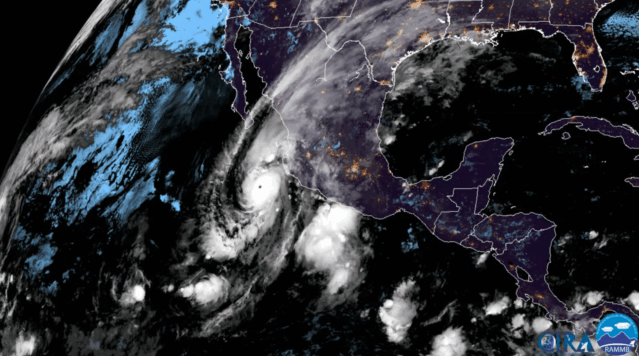
GOES East 17 satellite loop of Hurricane Willa. Source: NOAA
Intensity forecasts are also in fairly good agreement, with predictions of Hurricane Willa making landfall as a major hurricane. Deep ocean heat content and upper level divergence are favorable for intensification, however continuously increasing wind shear along the path prior to landfall is the primary limitation factor. Furthermore, there is evidence of the beginnings of an eyewall replacement cycle, which could slightly weaken but also broaden the wind field.
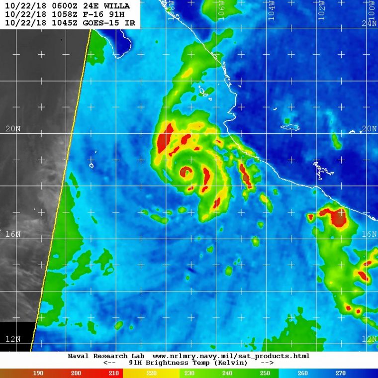
Microwave imagery of Hurricane Willa, showing a small compact eye, along with the beginnings of a secondary eyewall. Source: Naval Research Lab, US Navy
Impacts in Mexico:
A dangerous storm surge and large destructive waves are expected to impact a broad stretch of coastline as Willa approaches landfall on Tuesday, most significantly to the right of landfall. While landfall intensity is still uncertain, as evidenced by Hurricane Michael earlier this month, borderline category 4/5 winds can produce extensive structural and infrastructure damage, especially in the eyewall. Additionally, rainfall is expected to exceed 5-10 inches along the coast, with local totals even higher as the storm moves inland over the mountainous states of Zacatecas and Durango. As always power outages, wind damage and potential flash flooding and landslides are possible and likely well inland from the landfall location.
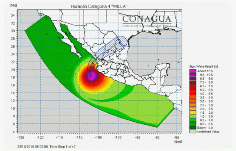
Significant wave height forecast for Hurricane Willa. Source: Conagua
Impacts in United States:
After moving across Mexico on early Wednesday morning, the storm is expected to take a path into central and southern Texas, which has already been experiencing well above average rainfall and associated flooding across the Hill County near Austin and San Antonio. Additional rainfall totals of 4-5 inches locally are expected, with the exact footprint being highly sensitive to the track of the hurricane. This level of rainfall is unlikely to cause urban or street flooding, but it is likely to swell already high rivers and cause additional localized riverine flooding. There may also be secondary impacts to agriculture, with the cotton crop being particularly vulnerable.
Seasonal Statistics and Storm Analogues:
Hurricane Willa is one of only a handful of category 4-5 storms to have formed in the Eastern Pacific Basin (EPAC) this late in the season, and it is recurving toward the Mexico coastline which is the favored path for late season storms. The map below shows all category 4+ storms in the mid Oct to Dec timeframe since 1957, with category 5 Hurricane Patricia in late October, 2015, highlighted in white. Hurricane Willa is extending an already very active 2018 hurricane season well into the fall. Willa is now the 3rd category 5 storm of the season, and overall is the 10th major (category 3+) hurricane of the season. Using Accumulated Cyclone Energy (ACE) as the metric, the 2018 season is 238% above average in the EPAC, and has exceeded the very active 1992 season in terms of the longevity and intensity of hurricanes in the basin. This is a particularly interesting and surprising statistic, considering the EPAC is not under the influence of El Nino conditions, which typically favor more activity.
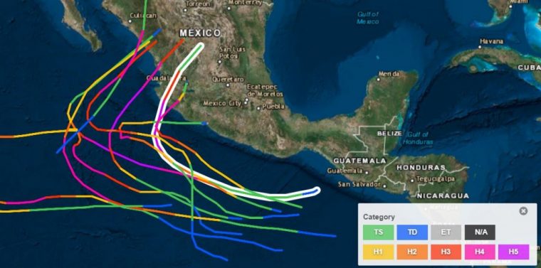
Eastern Pacific Basin Category 4+ Hurricane Tracks in late fall, with Hurricane Patricia highlighted in white. Source: NHC
Obvious parallels are being drawn between Category 5 Hurricane Willa and Category 5 Hurricane Patricia that made landfall south of Puerto Vallarta in October of 2015. Three years ago today, Hurricane Patricia was in a phase of rapid intensification which would eventually break records for intensity not only in the EPAC, but in the entire Western Hemisphere. Maximum sustained winds of 215 mph were present at it’s peak intensity prior to landfall. As is expected for Willa, the storm weakened slightly prior to landfall, however it remained a strong category 4 with winds of 150 mph at landfall. Damage was extensive in the state of Jalisco, mainly to agriculture and infrastructure, as it was a somewhat rural area. Hurricane Willa is forecast to make landfall further north, once again in a somewhat rural area, with an intensity likely in the category 3-4 range.