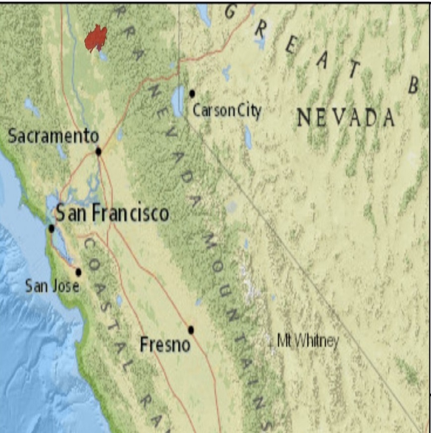
Wildfire activity has rendered especially severe impacts to areas of California, including areas of Butte, Los Angeles and Ventura Counties. Rates of extreme fire spread were enabled by especially dry, windy conditions on November 8, 2018, and the days following. Aggressive firefighting efforts allowed containment efforts to progress despite adverse conditions over the following week. Periods of heavy rainfall have recently allowed firefighting crews to bring the last of the fires to 100 percent containment over the last week. The Camp, Woolsey and Hill Fires have burned an estimated 20,297 structures since November 8, including at least 13,972 residential structures from the Camp Fire alone, according to Cal Fire statistics. These fires have also claimed at least 91 lives. Recent heavy rainfall has amplified the threat for flash-flooding and debris flows in and around the burn scars. Media reports indicate estimated insured losses for the Camp and Woolsey Fires of around USD 9-13 billion as reported by RMS. IWt will take some time to determine the full scope and severity of this event as search, recovery and survey efforts continue. Our first thoughts and concerns remain with those lost and directly affected by this event.
Event Background and Impacts
Northern California – Camp Fire
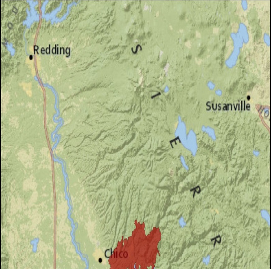
In Northern California, the Camp Fire has consumed an estimated 18,793 structures, making this the most destructive wildfire in recorded California history, according to Cal Fire statistics. This considerably surpasses the Tubbs Fire from 2017 which burned 5,636 structures. The Camp Fire has also has claimed at least 88 lives, according to media reports, and is the deadliest wildfire in recorded California history, surpassing the Griffith Park Fire from 1933 with 29 reported fatalities. The fire has consumed an estimated 153,336 acres since its discovery on November 8. Thousands of residents have been displaced. Search and recovery efforts continue in the meantime and at least 203 people remain missing. According to media reports, estimated insured losses for this event are around USD 7.5 to 10.0 billion as reported by RMS.

Hazard data illustrated in the GC AdvantagePoint users can view impacted areas on any map as well as see how their portfolios were affected. Please contact your broker or cat modeling analyst for further information.

Camp Fire Perimeter from GEOMAC (USGS), November 29, 2018.
The fire was able to spread under especially dry and windy conditions in the days following November 8, when it was initially discovered near Chico, California. The strong, dry offshore flow was driven by a strong area of high pressure over the interior Northwest. Strong winds and dry fuels allowed for extreme fire behavior and ember transport to rapidly spread the fire to the west and southwest through the communities of Paradise, Magalia and Concow where significant to complete damage was reported by media. Within two days the fire had burned over 100,000 acres. Aggressive firefighting efforts allowed partial containment but was hindered by ongoing extreme dry conditions in the days following November 8. Recent periods of heavy rain have allowed the fire to be brought to full containment as of November 25. The heavy rainfall has amplified the threat for flash-flooding and debris flows in and around the burn scars from the fire.
Status for the Camp Fire follows below, following statements from Cal Fire and media.
Butte County
Total acreage: 153,336
Fatalities: 88
Missing: 203
Injuries: 3
Structures destroyed: 18,793
Single Residence: 13,696
Multiple Residence: 276
Commercial: 528
Other Minor Structures: 4,293
Structures damaged: 564
Single Residence: 462
Commercial: 102
Containment: 100 percent
Southern California – Hill and Woolsey Fires
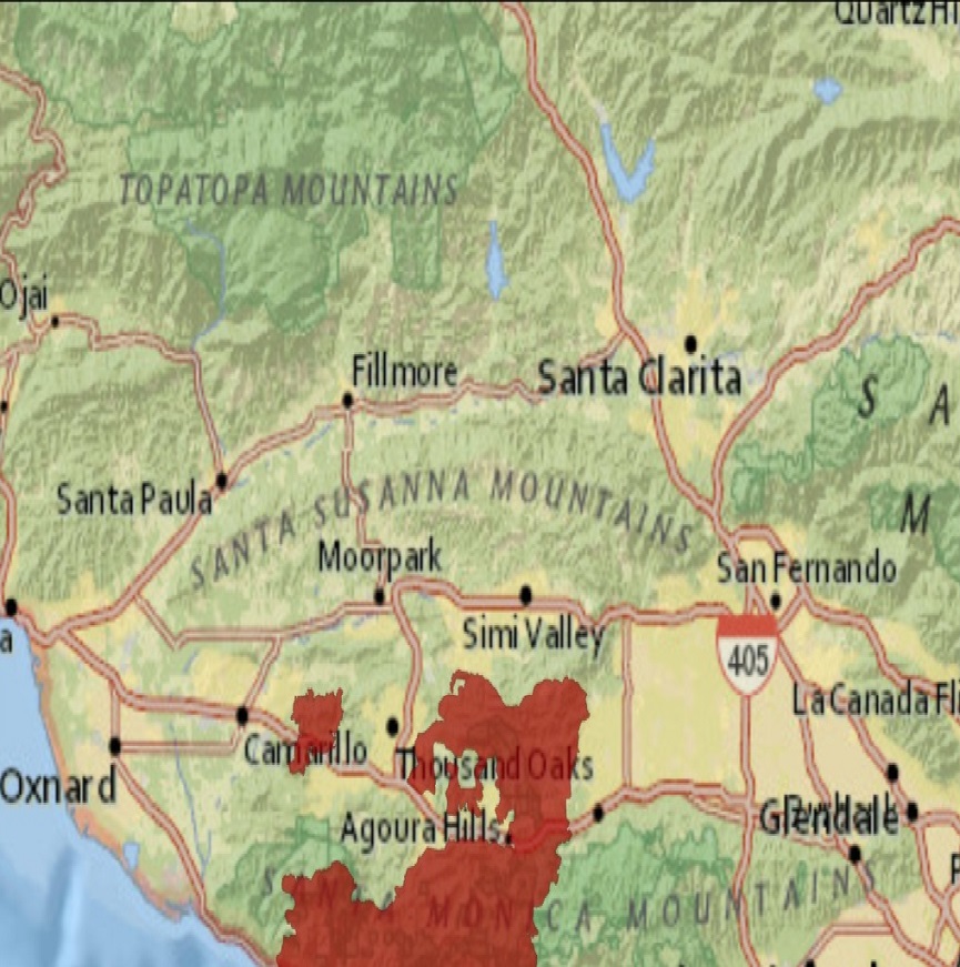
In Southern California, the Woolsey Fire has consumed an estimated 1,643 structures and 96,949 acres, according to Cal Fire. At least three fatalities and three injuries have been reported. Los Angeles County reports that this is the worst wildfire in its modern history. Affected communities include Thousand Oaks, Malibu and Calabasas. Media reports indicate estimated insured losses of USD 1.5 to 3.0 billion as reported by RMS.

Hill Fire (Left) and Woolsey Fire (Right) Perimeters from GEOMAC (USGS), November 29, 2018.
The Woolsey Fire was also discovered the afternoon of November 8 to the south/southeast of Simi Valley, California. Strong Santa Ana winds allowed the fire to quickly spread to the south, to eventually reach the coast after crossing the U.S. 101 freeway. Ongoing dry, windy conditions acted to offset firefighting efforts in the days following discovery. However aggressive firefighting efforts brought the fire under steadily improved containment. Increased moisture allowed the fire to be brought under full containment by the evening of November 21.
Further west, the Hill Fire burned about 4,531 acres and two structures, and was brought to full containment by the evening of November 16, according to Cal Fire.
Status for the Woolsey and Hill Fires follow below, following statements from Cal Fire and media.
Woolsey Fire
Los Angeles and Ventura Counties
Total acreage: 96,949
Fatalities: 3
Injuries: 3
Structures destroyed: 1,643
Structures damaged: 341
Containment: 100 percent
Hill Fire
Ventura County
Total acreage: 4,531
Structures destroyed: 4
Structures damaged: 2
Containment: 100 percent
Sources: Cal Fire, Reuters, U.S. Forest Service, U.S. Department of Agriculture, U.S. Geological Survey, U.S. National Weather Service, U.S. Storm Prediction Center, Associated Press, Los Angeles Times, New York Times, Agence France Presse, Insurance Journal, RMS, County of Los Angeles.
Guy Carpenter publishes CAT-i reports for major events. CAT.i@guycarp.com if you wish to be added to the free email distribution list.