
A long track tornado has affected portions of downtown Nashville and near suburbs; a core area just north of downtown has sustained significant damage to both residential and commercial structures along with multiple fatalities.
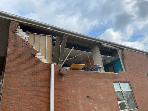
- An official NWS damage survey is still pending, yet initial reports indicate damage consistent with EF-3 winds, with destruction to walls of residential properties, and roof and siding damage to commercial structures as well as multiple fatalities.
- In addition to significant structural damage along the tornado path, there are also major disruptions to infrastructure, including power and water lines, and debris closing roads.
- The Nashville tornado was part of a line of thunderstorms that produced multiple tornadoes and large hail in portions of Missouri, Kentucky and Tennessee.
- Last night's tornado outbreak is third one of the year to date, indicating an fast start to the beginning of the 2020 severe weather season. While a fast start is not indicative of continued activity, the southern U.S. faces elevated risk basis normal through mid-March.
Meteorological Event Overview
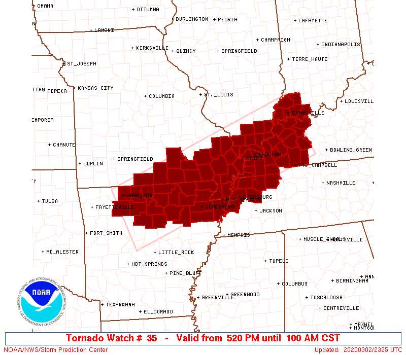
NWS Tornado Watch, issued at 5:20 pm CST Source: NOAA.SPC.GOV. At 5:20 pm CST, the National Weather Service issued a tornado watch for far western portions of Tennessee, in addition to portions of Missouri, Arkansas, Illinois and Kentucky. Increasing thunderstorm activity was observed ahead of a southeastward advancing cold front. The environment was conducive to isolated supercell development, which could produce large hail, strong winds, and a low probability of a severe tornado. The storm first prompted a tornado warning at 11:02 p.m., just as it was crossing over Benton County in western Tennessee. Reports of a possible tornado emerged near Camden, nearly 90 minutes before the storm arrived in Nashville. Baseball-sized hail accompanied the storm in Dickson, about 35 miles west-southwest of Nashville.
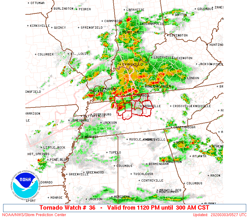
NWS Tornado Watch and initial radar, issued at 11:20 pm CST Source: NOAA.SPC.GOV. As storm activity increased across western TN, an additional tornado watch was issued for middle Tennessee, including Nashville, at 11:20 pm CST. Radar imagery above indicates a well developed supercell entering the western portion of the warning area at this time. At approximately 12:35 am CST, a tornado warning was issued for Nashville. Radar indicated a large and damaging tornado on the ground directly over the state prison on the Cumberland River, on the west side of Nashville. The National Weather Service issued a rare statement about a "particularly dangerous situation", as the tornado proceeded on a track that ended about 10 miles east of the city, in Hermitage, TN. Initial estimates are that the tornado may have been on the ground for up to 25 miles in total. As the storm progressed to the east, an additional tornado touched down near Baxter and Cookeville, TN, at 2 am CST.
Tornado Impacts
According to the Nashville Fire Department, at least 48 buildings have collapsed in the city. Additional residential structures in the community of Mount Joliet have been damaged, and there are injuries reported among residents. As of 4 am CST, 44,000 residents were without power, according to Nashville Electric Service. Many roads are impassible with debris, including Main Street in Nashville. National Weather Service damage assessment teams are scheduled to survey those sites affected by apparent tornado activity, although this will only occur after affected sites have been secured and are deemed safe to enter by local authorities. Once damage assessment results have been analyzed, preliminary tracks and EF-ratings will be assigned and then released by the National Weather Service. However, initial estimates of damage indicate winds consistent with an EF-3 tornado in Nashville. The Nashville Emergency Response Viewing Engine has published detailed information on impacted areas, inclusive of evacuation areas which closely mirror the tornado track through Nashville, which can be found HERE.
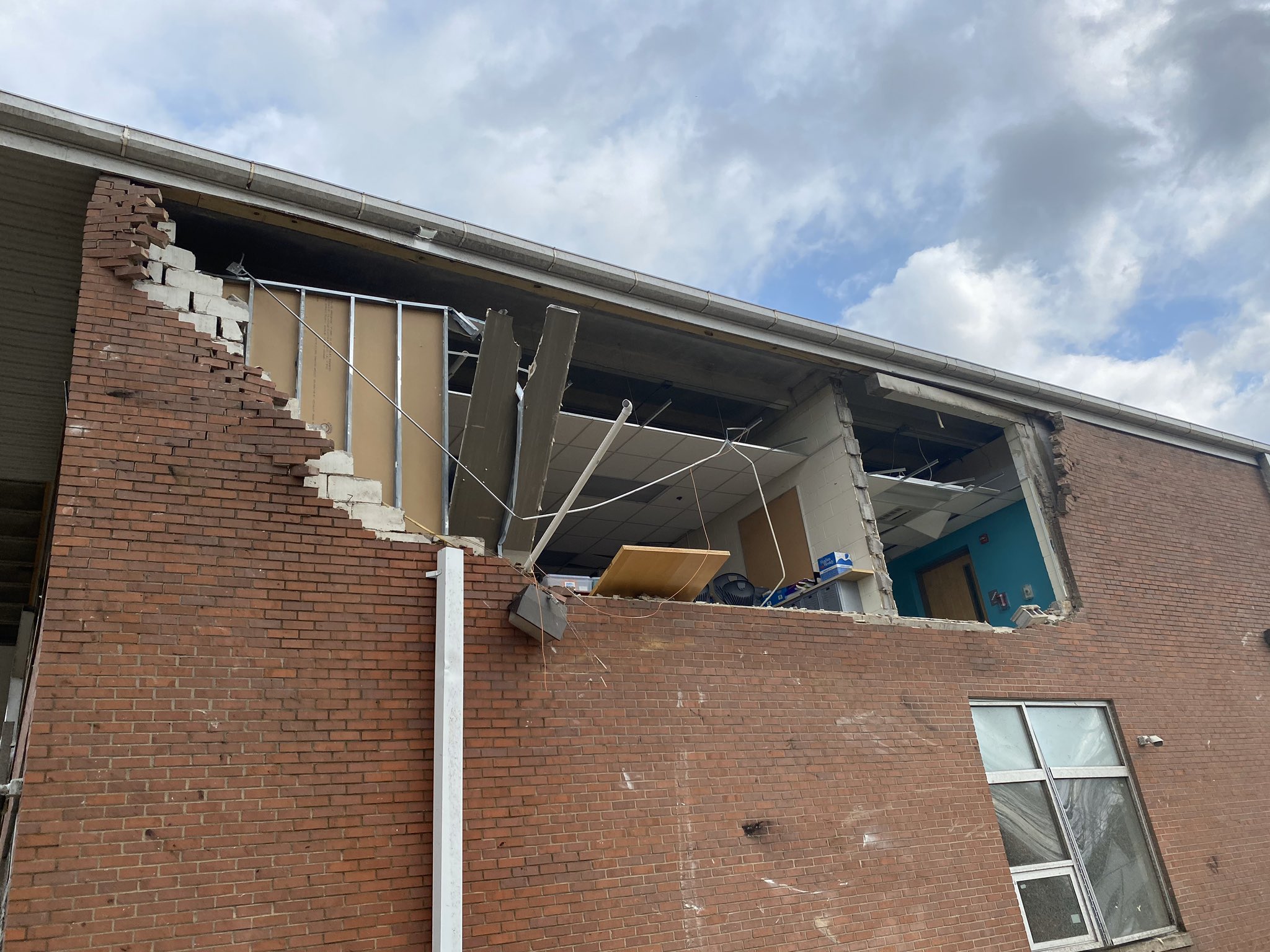
Damage to Robert Churchwell Elementary School, just west of downtown Nashville Source: Metro Schools of Nashville - Twitter Handle @Metroschools[/caption] I
mplications for 2020 Severe Weather Season
Last night's tornado outbreak was part of the third significant convective storm outbreak so far in 2020. What implications do early outbreaks have on the rest of the season?
- An early start does not always mean continued elevated activity: For tornado activity, 2020 thus far is already pacing well behind the two most active starts of 2012 and 2008, dating back to 2005. 2012 finished the year below average, while 2008 was the most active tornado season of the last 15 years from a tornado count perspective.
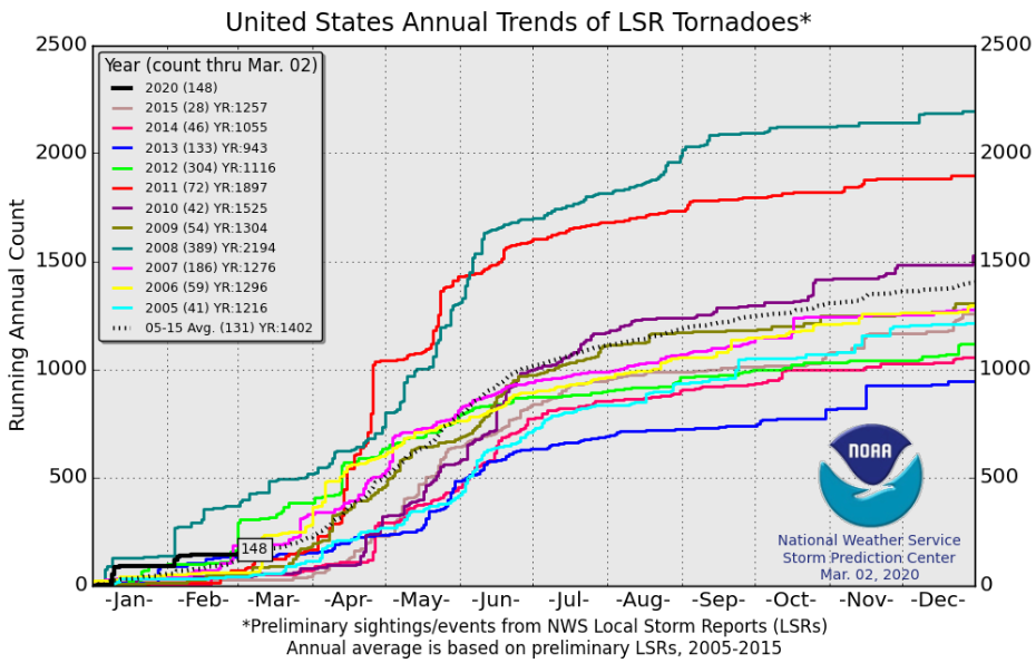
Local storm reports of tornadoes in 2020 compared to all seasons back to 2005. Source: SPC/NWS[/caption]
- Yet, the extended range forecast through mid-March 2020 features slightly elevated regional risk: Dr. Victor Gensini, of Northern Illinois University, has spearheaded a methodology to predict elevated periods of tornado activity in the U.S. over the following four week period, available HERE. The current ERTAF (Extended Range Tornado Activity Forecast) calls for slightly elevated tornado prospects in the period of March 8 through March 21, particularly in the Arkansas / Louisiana / Texas region.

The active southern branch of the jet stream across North America, shown here this morning, is expected to persist over the next several weeks, favoring southern U.S. activity. Source: Northern Illinois University

Split jet stream flow, with an active southern sub-tropical jet is forecasted through mid-March by the GFS model favors. This configuration favors heightened prospects for severe weather across the southern U.S. Source: tropicaltidbits.com. Guy Carpenter experts are actively monitoring the rescue efforts and damage assessments ongoing in the Nashville metropolitan region. A post-event CAT-i report is anticipated to be issued in one week's time given the potential impact this event can have on the property insurance industry.