A probable severe thunderstorm outbreak will affect portions of the Southern Plains and Southeast over the coming weekend, to include possible long-track, destructive tornadoes, significant hail and damaging straight-line winds.
Summary
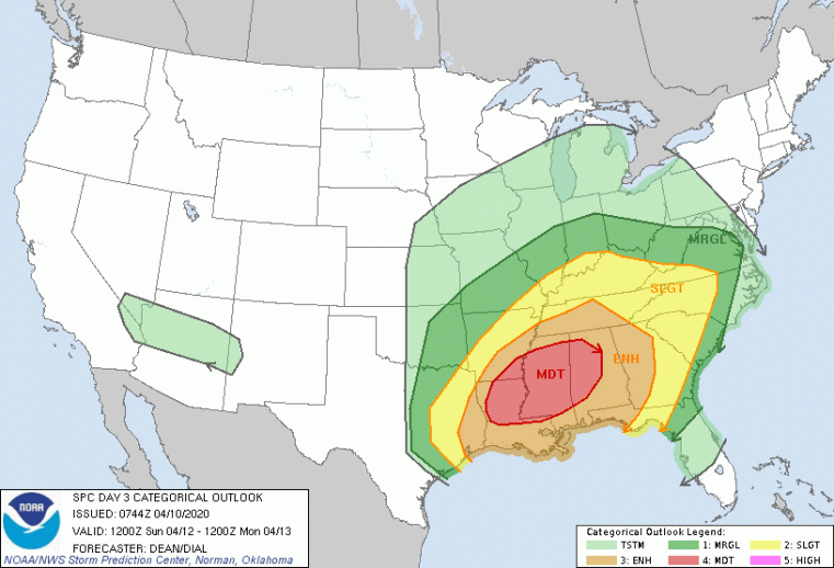
- The U.S. Storm Prediction Center (SPC) has flagged areas under potential threat, including a rare moderate risk area on Sunday from western Louisiana to eastern Alabama.
- Areas under greatest threat for Sunday include Birmingham, Alabama, Jackson, Mississippi, Tuscaloosa, Alabama, Hoover, Alabama and Monroe, Louisiana.
- It is very possible that the SPC will upgrade this to a rare high-risk over coming forecast cycles. Only 18 day-3 moderate risk outlooks have been issued by the SPC, and five of the last ten of these were upgraded to high risk.
- For Sunday, a threat for destructive long-track tornadoes will affect areas from western Louisiana to eastern Alabama. A general threat for significant hail and damaging straight-line winds with some tornadoes will affect a larger area from the Southern Plains to the Southeast.
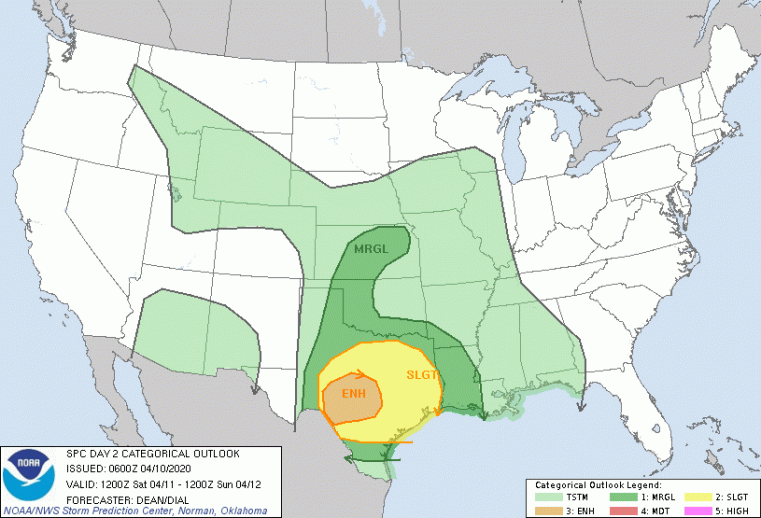
- A slight to enhanced risk will affect portions of the Southern Plains for Saturday.

Severe Thunderstorm Outlook for Saturday April 11. Source: NOAA/SPC.

Severe Thunderstorm Outlook for Sunday April 12. Source: NOAA/SPC.
Expected Impacts
Residential structures affected by significant tornadoes may suffer complete damage, with significant damage even to engineered structures. In the meantime hail will cause potential roof impact and possibly some wall damage. Downed trees and powerlines can also be expected for affected areas from the Southern Plains to the Carolinas, along with light to moderate property damage from straight-line winds.
Expert Discussion
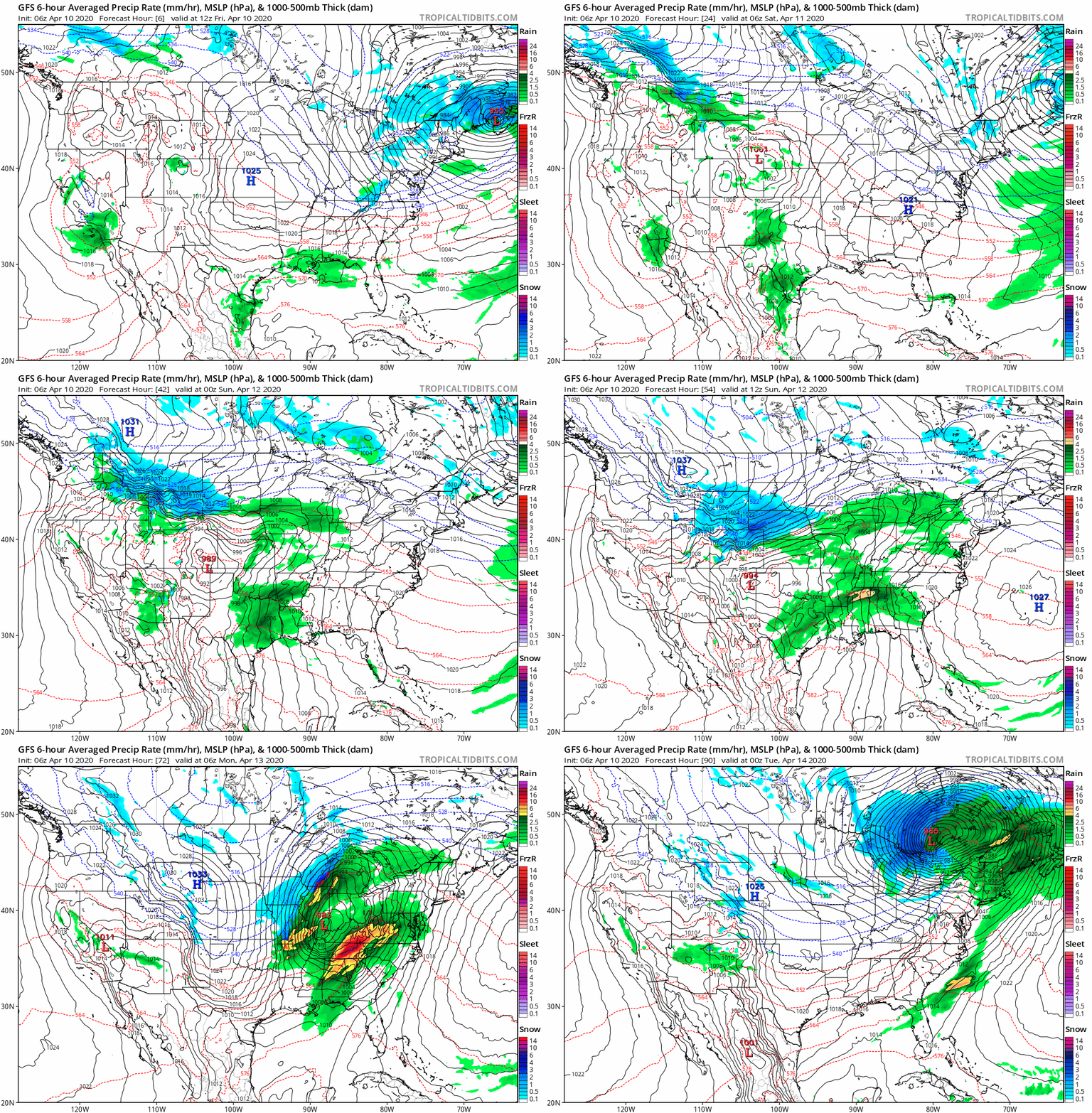
The expected threat comes with an environment of warm, moist unstable air from the Gulf of Mexico. Robust wind shear is also expected due to strong low-level and upper-level winds associated with a strong surface frontal system. As the surface system advances from the Southern Plains towards the Great Lakes, thunderstorms should initiate in this environment, over the Southern Plains Saturday before moving to the Lower Mississippi Valley Sunday, reaching the Carolinas by Monday morning. Thunderstorms Saturday should produce significant hail as the primary expected threat along with damaging winds and a few tornadoes. As thunderstorm activity reaches the Lower Mississippi Valley on Sunday, the forecast environment will enable supercell thunderstorms capable of producing long-track destructive tornadoes along with significant hail and damaging straight-line winds. As discrete thunderstorms organize into lines overnight Sunday into Monday, the primary threat should shift to favor damaging straight-line winds, along with some hail and a few tornadoes per the SPC.

Forecast Surface Pressure (black lines) and Precipitation Rate (shaded) Friday through Monday (GFS Model). Source: NOAA/SPC.
Useful Links
- Official watches and warnings, and statements from emergency management agencies supersede this update, and should be closely followed concerning matters of personal safety.
- Updated statements from the SPC can be found at www.spc.noaa.gov.
- Local watches and warnings can be found at www.weather.gov for U.S. locations.