

A threat for severe thunderstorms today will affect areas from the Ohio Valley to the Central Great Lakes and Saint Lawrence Valley, including Southern Ontario Canada. The U.S. Storm Prediction Center (SPC) has flagged areas under threat today, with a rare moderate risk area for portions of the Lower Great Lakes.
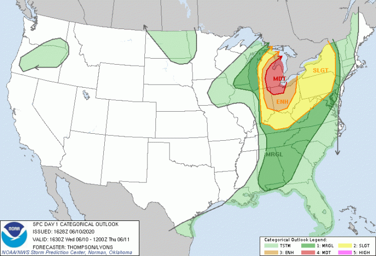
Severe Thunderstorm Outlook for June 10 with red area indicating rare moderate risk for severe weather, surrounded by enhanced (orange), slight (yellow) and marginal (dark green) threats. Source: NOAA/SPC.
- Straight-line winds are the primary threat expected by the SPC today, along with hail and some tornadoes. Significant wind gusts in excess of 75 mph are very possible, especially in the moderate-risk area.
- Severe thunderstorm watches are now active per the SPC from the Ohio Valley to the Central Great Lakes. The Meteorological Service of Canada has also issued severe thunderstorm watches for areas from the Central Great Lakes to portions of the Saint Lawrence Valley. These will evolve as the situation unfolds today. Damaging wind gusts have already been reported by the SPC in portions of northern Indiana and western Michigan, including a wind gust of 75 mph in Kent County, Michigan. Recent severe thunderstorm warnings indicate the potential for wind gusts to 85 mph per the U.S. National Weather Service.
- The threat comes with very warm, moist and unstable air and strong wind shear, ahead of a very potent frontal system crossing the area. These factors will enable discrete thunderstorm activity that should rapidly organize into linear features with straight-line winds as the primary threat.
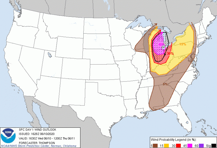
Probability of straight-line wind gusts exceeding 58 mph, with significant-severe potential shown by the black hashed region where wind gusts could exceed 75 mph. Source: NOAA/SPC.
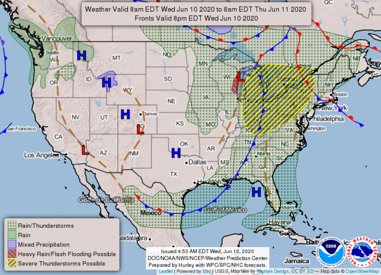
Daily weather map for June 10 showing frontal system crossing the area under threat, and the threat for severe thunderstorms shown in yellow. Source: NOAA/SPC. Updates on this active event will be available from the following agencies:
- U.S. Storm Prediction Center: www.spc.noaa.gov
- U.S. National Weather Service: www.weather.gov
- Meteorological Service of Canada: https://weather.gc.ca/
Statements from official forecast agencies and local emergency management supersede this update and should be closely followed concerning matters of personal safety. Weather Sentinel notification emails are available on a subscription basis at the GC Preference Center. Daily, global tropical cyclone alerts are also now available from GC at this link.