
An escalating threat for severe thunderstorms is affecting areas of the Midwest this afternoon. The U.S. Storm Prediction Center (SPC) has flagged areas under threat, including a rare moderate risk area from Iowa to the Michigan/Indiana line. Damaging straight-line wind gusts are the primary threat expected by the SPC. In particular, concentrated significant wind gusts in excess of 75 mph with an impactful derecho event are increasingly probable. Significant wind gusts have already been reported by the SPC for portions of Iowa. Severe thunderstorm watches remain active for this event, including a “Particularly Dangerous Situation” watch centered along the I-80 corridor including the Chicago Metro area.
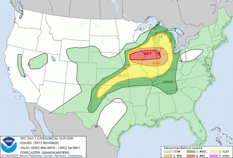
Severe Thunderstorm Outlook Monday August 10. Source: NOAA/SPC.
Thunderstorm Activity So Far
- Severe thunderstorm activity is ongoing across portions of Iowa.
- Significant tree and structural damage has been reported across Central Iowa per the SPC.
- A 99 mph wind gust was reported at Marshalltown Airport.
- Power outages to well over 136,000 customers have been reported in Central Iowa according to initial reports, and this number continues to grow.
- Initial media reports indicate semi-trailers blown over along I-80.
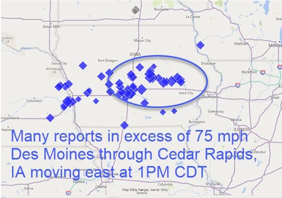
Damaging wind gust reports of 60 mph or more through 1 PM CDT Monday August 10.
Source: NOAA/SPC.
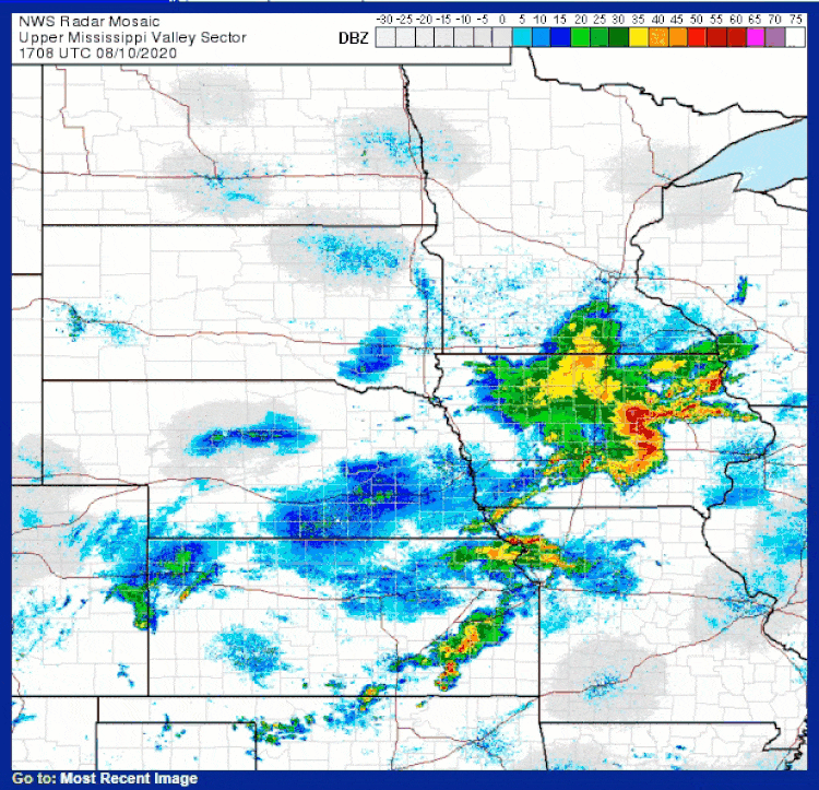
Radar Loop Ending 1:08 PM EDT (1308 UTC). Note the strong line of thunderstorms crossing central Iowa. Source: NOAA/NWS.
Expert Discussion
The threat comes with very moist, unstable air and robust wind shear and upper-level support. A passing disturbance has already initiated thunderstorms in this environment as it crosses the edge of a strong ridge further to the south and an associated surface front. The environment has produced a very strong line of thunderstorms with clustered damaging wind gusts that should progress through the moderate risk area over the coming hours.
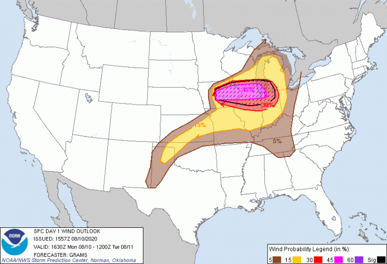
Probability of Damaging Straight-Line Wind Gusts. Note the black hatched region with potential for significant wind gusts of 75 mph or more. Source: NOAA/SPC.
Useful Links
- Official watches and warnings, and statements from emergency management agencies supersede this update, and should be closely followed concerning matters of personal safety.
- Updated statements from the SPC can be found at www.spc.noaa.gov.
- Local watches and warnings can be found at www.weather.gov.