
Tropical Storm Sally has been bringing heavy rainfall and winds to portions of Florida over the weekend, and is now emerging into the Gulf of Mexico. Both of the best predictors for strengthening are present; namely very warm waters and low wind shear. A hurricane landfall along the Central Gulf Coast, with the threat of heavy rainfall, strong winds, and a dangerous storm surge is now likely.
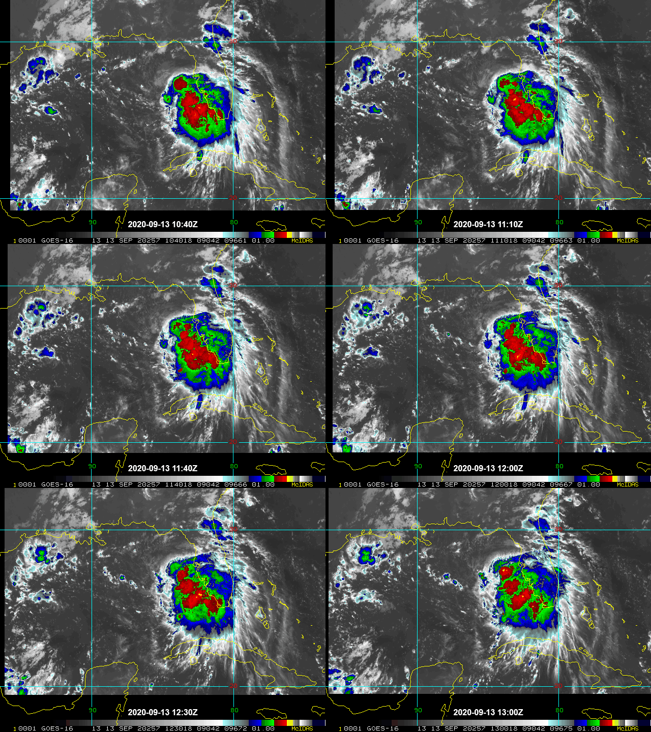
Satellite loop (infrared) of Tropical Storm Sally in the Gulf of Mexico Source: NOAA/NESDIS.
- Tropical Storm Sally is currently located about 45 miles due West of the Tampa Bay area and is moving slowly to the northwest in the Gulf of Mexico. Peak winds are 50 mph, with a falling central pressure indicative of strengthening.
- Satellite imagery indicates that thunderstorm activity is increasing near the center of the storm, which is typically a precursor to strengthening; the storm is being fueled by waters that are a degree or two warmer than normal for this time of year.
- The ambient environment is conducive to strengthening as well, with an upper level high positioned over the Gulf. High pressure aloft essentially acts as a vent for the outflow, which encourages warm air to rise at the surface. This type of set up, in combination with ocean heat content, could provide the ingredients for (rapid) intensification.
- Steering currents will gradually slow the system down and bring it onshore along the Central Gulf Coast. The weakening steering currents mean the forward speed of the storm will slow, which is a concern for flooding from both storm surge and rainfall.
- The gradual slowing of the system also increases the uncertainty in the intensity at landfall. The water in the immediate coastal area is very warm; if Sally slows and spends more time over warm water it could allow for additional strengthening.
- The official intensity forecast is for Sally to strengthen to a category-1 hurricane prior to landfall in Louisiana. As has been the case all season, the actual intensity and track forecast is still highly uncertain, and interests along the entire Central Gulf Coast, including New Orleans, should be prepared for a hurricane landfall and associated risks.
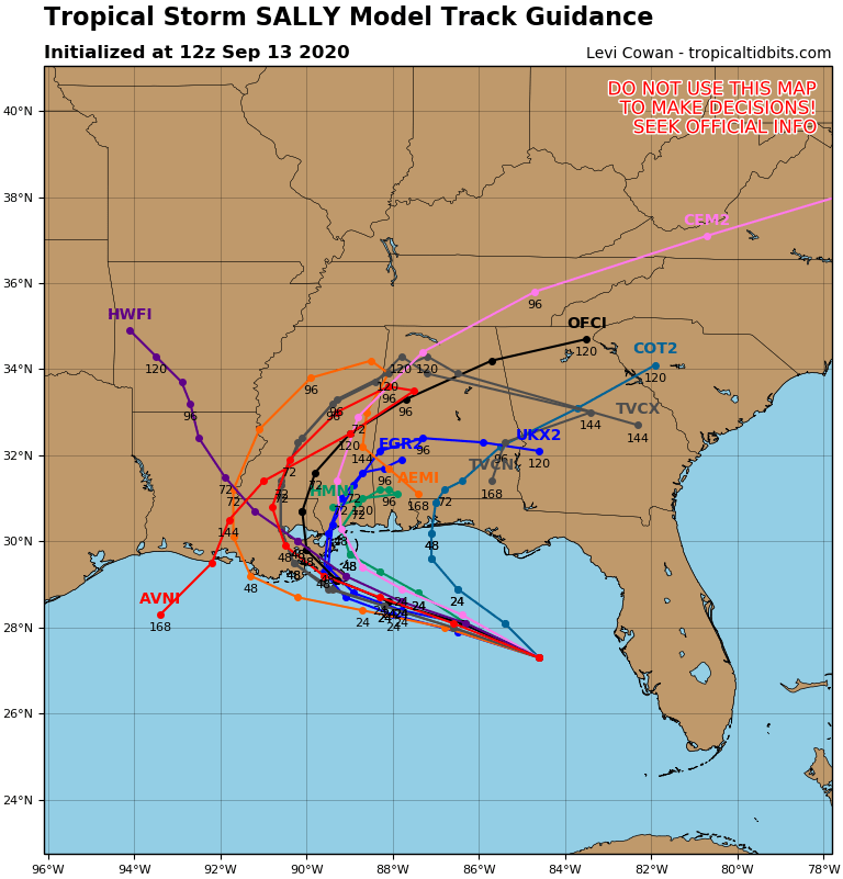
Ensemble Track Forecast Source: Tropical Tidbits.
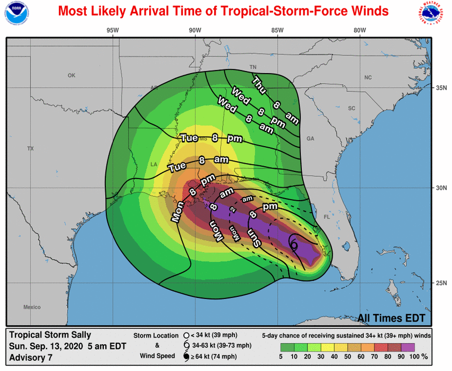
Most likely arrival time for tropical storm force winds Source: NOAA/NHC.
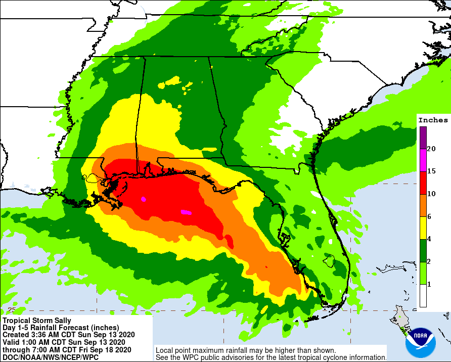
Tropical Storm Sally 5 day rainfall forecast Source: NOAA/NWS.
- Elsewhere in the Atlantic at the peak of hurricane season, there are six active storms ranging from disturbances to tropical depressions to hurricanes.
- Category-1 Hurricane Paulette is approaching Bermuda and expected to bring heavy rainfall, storm surge, and a period of prolonged strong winds.
- Models are in good agreement that Paulette should pass near or over Bermuda in the next 24 to 36 hours.
- Paulette will be moving into a low shear environment as it passes near Bermuda, and strengthening is likely prior to landfall or a near bypass of the storm.
- There have only been nine direct hurricane landfalls in Bermuda since 1851, the most destructive of which was category-3 Hurricane Fabian in 2003.

NHC official forecast for Hurricane Paulette Source: NOAA/NHC.
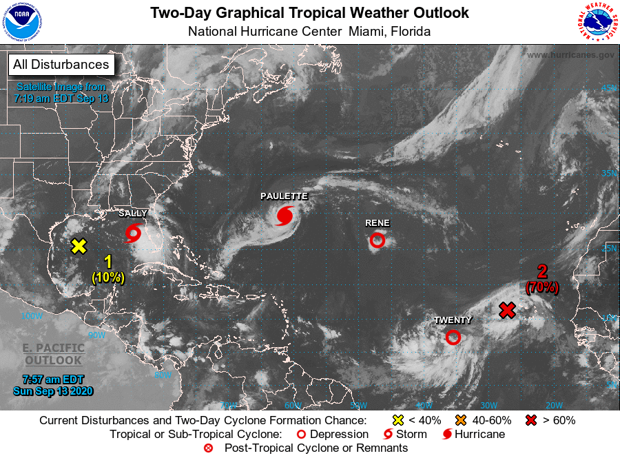
Two Day Outlook for Atlantic Basin Source: NOAA/NHC.
U.S. National Hurricane Center
American Meteorological Society COVID-19 & Hurricane Evacuation Guidance
Official statements from the NHC and U.S. National Weather Service, and those of emergency management agencies supersede this update, and should be closely monitored concerning matters of personal safety.