
Typhoon Haishen is an escalating threat to portions of Japan and the Korean Peninsula over the coming days, with the threat of destructive winds and heavy rainfall. This threat comes after Typhoon Maysak followed a similar track earlier in the week, with reports of heavy rainfall and inland flooding, and wind damage with downed trees and powerlines.
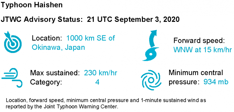
- Typhoon Haishen is a category-4 with 1-minute sustained winds of around 230 km/hr, according to the Joint Typhoon Warning Center (JTWC).
- The storm is strengthening and should reach category-5 or Super Typhoon status over the coming hours, in an environment with very warm waters and reduced wind shear.
- Haishen is expected by the JTWC to follow a slow turn to the north-northwest through 18 UTC September 5, as it follows the southwestern edge of a subtropical ridge. The storm should weaken to a category-4 by this time, before moving near or over portions of Japan.
- By 18 UTC September 6, the typhoon is forecast to weaken further, with 1-minute sustained winds of around 195 km/hr, a category-3 on the Saffir-Simpson Scale, before making close-approach to Sasebo, Japan and final landfall on the Korean Peninsula.
- There is some uncertainty in the track forecast, with some spread in model guidance. As an example, the image below shows different track scenarios under the same model with a slight change in initial conditions.

Model (GEFS) track scenarios (lines) and pressures (shades) for Typhoon Haishen. Each track represents one scenario of the same model under slight adjustment of initial conditions. Source: Tropical Tidbits.
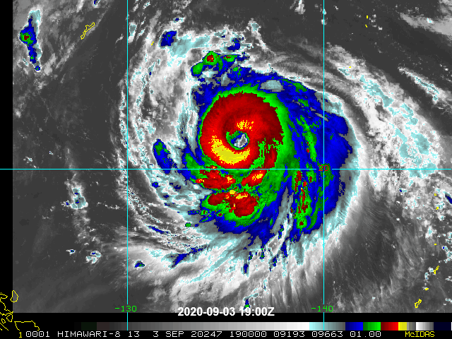
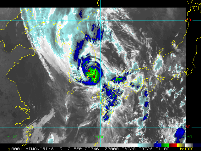
Satellite loop (infrared) of Typhoon Haishen ending 2230 UTC September 3. Source: NOAA/NESDIS.
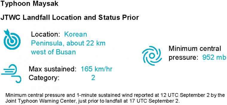
- On a track very close to Haishen, Typhoon Maysak made landfall earlier this week on the Korean Peninsula around 17 UTC September 2, about 22 km west of Busan.
- At 12 UTC prior to landfall, Maysak carried 1-minute sustained winds of around 165 km/hr per the JTWC, a category-2 on the Saffir-Simpson Scale.
- Wind gusts of around 140 km/hr were reported in Busan as the storm moved ashore, and there are reports of variable wind damage with greater severity near the center of the storm’s path.
- Heavy rainfall also produced inland flooding, with effects worsened by earlier monsoon rains.
- Initial media reports indicate over 2,200 evacuated and 120,000 without power in the affected area and at least two killed in the City of Busan.
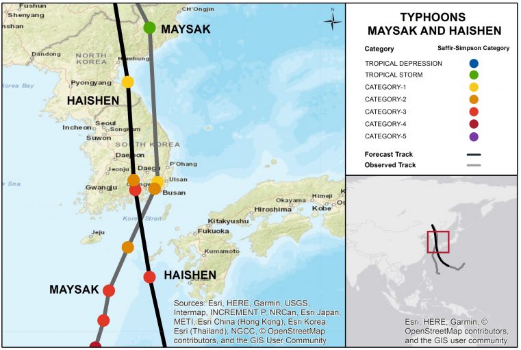
Closer view of the observed track of Typhoon Maysak (gray) and forecast track of Typhoon Haishen (black), both affecting the Korean Peninsula. Source: JTWC.
Satellite image (infrared) of Typhoon Maysak around the time of landfall at 17 UTC September 2. Source: NOAA/NESDIS.
Email alerts for Weather Sentinel and CAT-i reports are available on a subscription basis at the GC Preference Center here.
Daily, global tropical cyclone alerts are also available on a subscription basis here.
Statements from official forecast and emergency management agencies supersede this update, and should be closely followed concerning matters of personal safety.