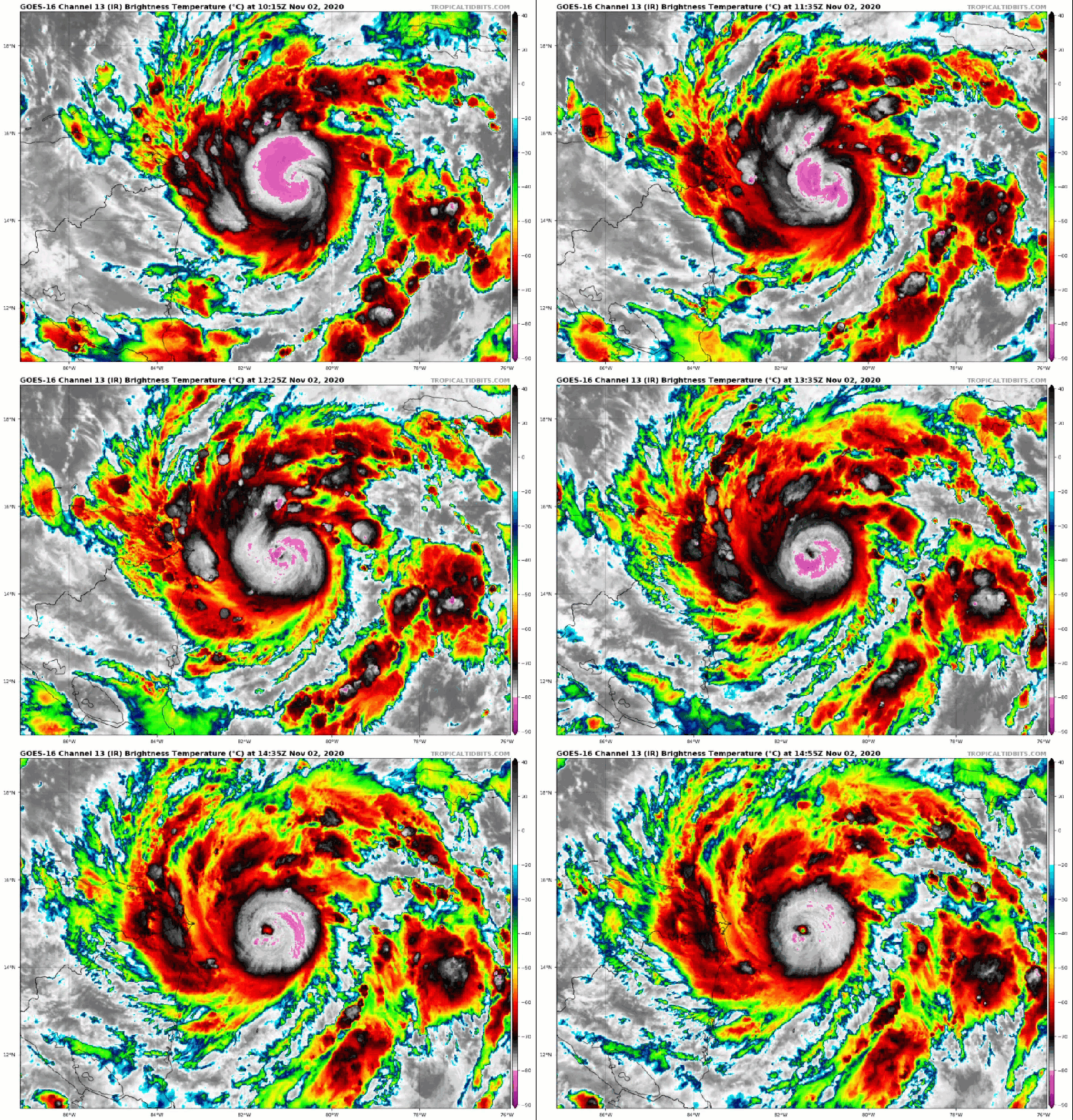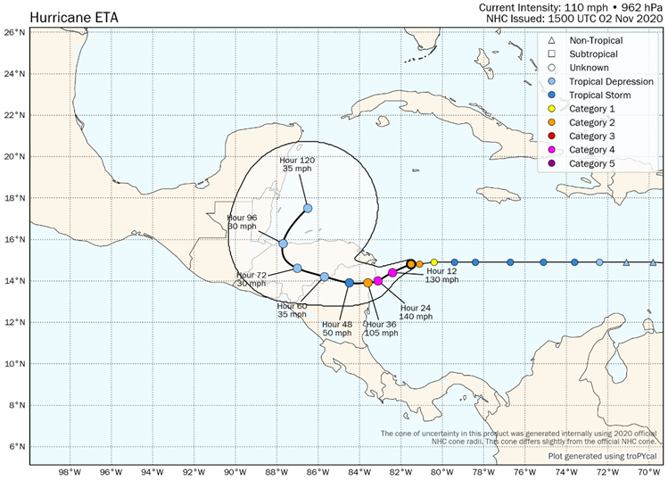
Eta developed in the western Caribbean Sea on Saturday, October 30 and has since rapidly intensified. The NHC forecast calls for Eta to become a major hurricane this afternoon and potentially reach category-4 strength before making landfall on the northeast coast of Nicaragua early Tuesday. Eta will be in rare company as only eight hurricanes since 1851 have reached major hurricane status after November 1, the most recent being Otto in 2016.

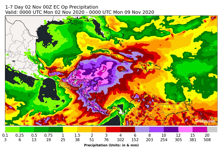
Catastrophic Impacts for Nicaragua The latest NHC forecast calls for Eta to make landfall with maximum sustained winds of 140 mph tomorrow morning. Once Eta moves onshore, the hurricane will move very slowly over the course of the next five days, resulting in torrential rainfall and widespread flooding and potential mudslides. Rainfall totals in excess of 20" are possible across several countries including Nicaragua, Honduras, Belize and Guatemala.

Infrared satellite loop of rapidly intensifying Hurricane Eta. Source: Tropical Tidbits.

Seven day rainfall forecast for Hurricane Eta. Source: Riskpulse.
In addition to widespread destruction due to high winds and excessive rainfall, storm surge is anticipated to be 12-18 feet in northeastern Nicaragua overnight and into tomorrow morning as Eta makes landfall. Longer term, Eta may move back into the western Caribbean late this week and potentially reform. Weather models suggest that Eta will slowly emerge back into a tropical storm over the weekend, which will be an item to watch through the course of the week.

NHC forecast for Hurricane Eta. Source: TroPYcal and Sam Lillo.
Updates and Useful Links
Guy Carpenter meteorologists will continue to monitor the progress of Hurricane Eta and issue updates as warranted.
U.S. National Hurricane Center