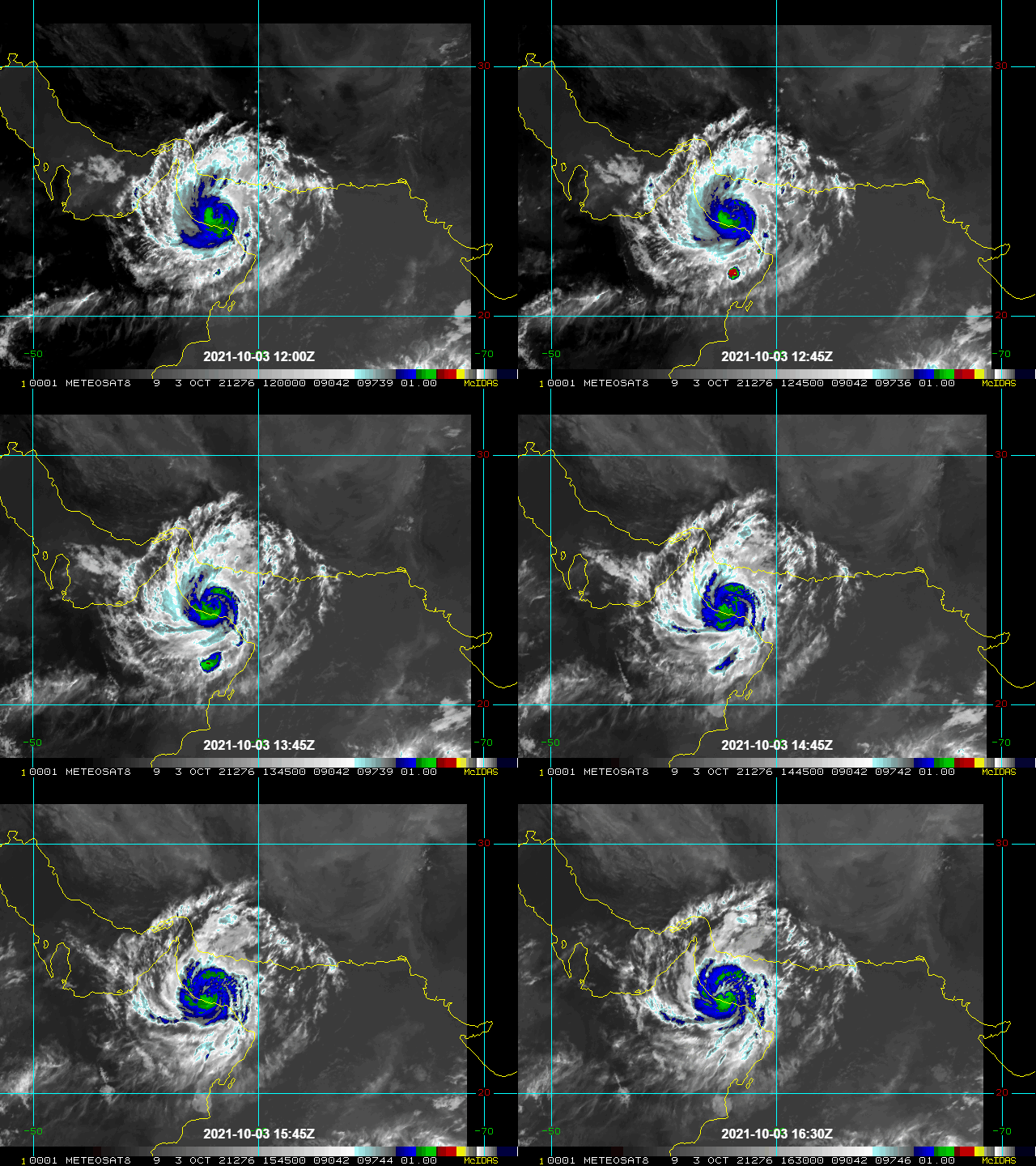


- First significant storm to hit the region since Mekunu in 2018.
- Made landfall at Al Masnaah, Oman on Sunday (October 3) as a category-1 equivalent storm.
- Strong winds and heavy rainfall were experienced across Oman and adjacent coastal areas during Sunday (October 3) and Monday (October 4).
- Power suspensions, widespread flooding and at least twelve fatalities have been reported in the region.
The Tropical Cyclone Shaheen post-event report comprises the following sections:
- Tropical Cyclone Track and Wind Speeds
- Regional Impacts
- Physical Discussion
Tropical Cyclone Track and Wind Speeds
Wind speeds of up to 150 km/h (93 mph) were forecast and reported to affect northern Oman, where Shaheen made landfall as a category-1 equivalent storm. Upon landfall, tropical storm intensity winds associated with Shaheen affected areas further inland of Oman, with lower wind speeds in Saudi Arabia and the United Arab Emirates as the low-pressure system moved inland and weakened. Figure 1 below shows the track and winds (estimated 1-minute sustained) associated with Shaheen, as provided by Kinetic Analysis Corporation and visualised in GC AdvantagePoint.

Regional Impacts
Oman
Tropical cyclone Shaheen is the largest storm to hit Oman since Mekunu in 2018, and the first cyclone in the satellite era to cross the Gulf of Oman from east to west, making landfall in the northern coast of Oman. With category-1 equivalent intensity at landfall, Shaheen brought heavy rain and winds of up to 150 km/h (93 mph) to the coastal areas (Source: Al Jazeera, BBC). The strongest winds occurred on Sunday (October 3), while rainfall affected the area until Monday (October 4), and the Civil Aviation Authority of Oman issued warnings of maximum wave heights between 3 and 5 meters.
At least twelve fatalities have been claimed by Shaheen, and schools have been suspended in the governorates of South and North Al Batinah (Source: Times of Oman). Shaheen brought 369 mm of rainfall to Khabourah over two days, more than three times the average annual rainfall of Oman (Source: Muscat Daily). Al-Khaboura and Al Suwaiq also recorded rainfall exceeding 300 mm, according to the statistics issued by the Ministry of Agriculture, Fisheries and Water Resources. Many locations in northern Oman have reported flooding and loss of power supply.
United Arab Emirates and Saudi Arabia
Shaheen weakened into a tropical depression as it moved inland, impacting the United Arab Emirates and Saudi Arabia on Monday (October 4). Winds of up to 55 km/h were expected, together with medium rainfall and several thunderstorms which led to lighter impacts in these countries relative to those experienced in Oman (Source: Khaleej Times, Arab News).
Observed Wind Speeds
The following table displays some observed wind speeds in Oman due to tropical cyclone Shaheen.

Physical Discussion
A tropical depression developed over the Bay of Bengal on September 24-25 and gradually moved westward towards the east coast of India, before making landfall as an equivalent tropical storm. As this low-pressure system traversed across the Indian subcontinent, it weakened into a tropical disturbance, whose remnants eventually entered the warm waters of the Arabian Sea by September 30. These warm waters enabled it to re-strengthen into a tropical storm, later named Shaheen. It then further strengthened into a category-1 equivalent tropical cyclone before making landfall at Al Masnaah, Oman on October 3. Shaheen weakened into a tropical depression as it moved inland into Saudi Arabia. The track and position reports of Shaheen are shown in Figure 2 below.

Tropical Cyclone Shaheen is the strongest storm to make landfall on the Oman coast since Mekunu made landfall as a category-3 equivalent in 2018. Earlier in 2007, Gonu strengthened to category-5 equivalent status over the Arabian Sea, before weakening to category-2 equivalent status on approach to the Gulf of Oman and close-approach to the Oman coast.
While it is generally difficult to attribute a particular storm event to climate change, studies have suggested that climate change is likely to increase the chance of intense tropical cyclones developing in the Arabian Sea and many other ocean basins due to warming sea surface temperatures (e.g. Murakami et al. 2017). Figure 3 suggests that the sea surface temperature in the Gulf of Oman reached 28oC in early October, several degrees above normal (while 26oC is generally considered as the minimum sea surface temperature needed to sustain a tropical cyclone). This means that larger swaths of the Arabian Sea will become warm enough for tropical cyclones to develop in a warming climate. In addition, physical arguments and multiple climate simulations have suggested that climate change will likely increase rainfall rates induced by tropical cyclones, due to the increase in moisture capacity of a warmer atmosphere.

Statements from official meteorological and emergency management agencies supersede this update, and should be closely followed concerning matters of personal safety.