Key Headlines
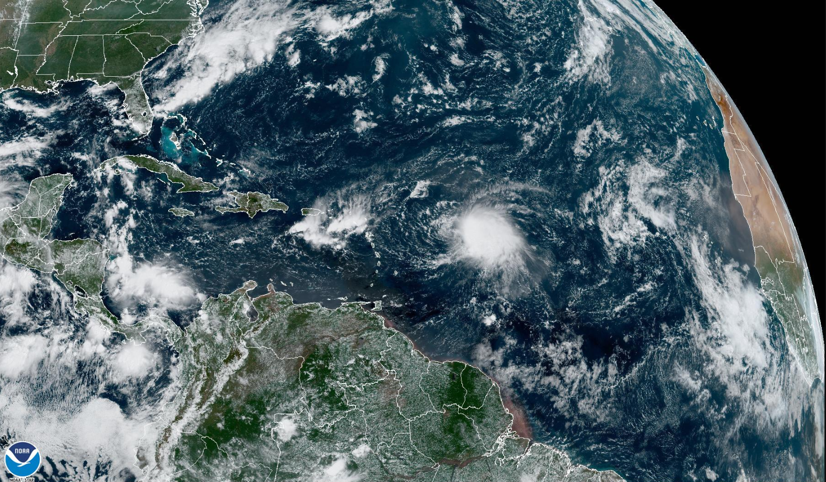
- Tropical Storm Fiona to Track over Greater Antilles this Weekend: By Friday afternoon, the National Hurricane Center anticipates initial interaction with the northern Leeward Islands, thereafter tracking close to the Virgin Islands and Puerto Rico over the weekend. Model guidance and the NHC forecast indicate a high likelihood of remaining at tropical storm strength over the next five days due to higher wind shear to the north and battling the Saharan air layer near the storm.
- What Happens Longer Term? Beyond five days, guidance is lacking consistency in longer term projections, in part due to possible weakening of the storm from interaction with the mountainous regions of the Dominican Republic and Haiti. Weather model trends are starting to indicate a potential turn to the north early next week, east of the Bahamas. In general, if Fiona intensifies quickly after departing the Caribbean, the storm is likely to turn to the north and east more quickly. A weaker storm will tend to track further to the west. Needless to say, weather models over the next 72 hours will be of keen interest to monitor further model trends.
- At the Climatological Peak of the Season: Mid-September represents the traditional peak of the Atlantic season. Weather models are sporadically indicating additional storm development in the last third of September. However, there have been many false alarms at a forecast lead time beyond a five day projection this season. At this time, there is no indication that there would be a flip to above average activity in the Atlantic basin through the end of September.
- How Rare is the Lack of Atlantic Activity Prior to Fiona? Prior to Fiona, only three years have had two or less named storms from July 2 to September 12: 1968, 1982 and 1992. All three of these seasons resulted in below average basin activity. Each season had one landfalling hurricane, with Andrew being the strongest at category-5 strength in 1992.
- What About October? Entering October, the potential for hurricane and major hurricane development in the basin is roughly half of the probability at the peak of the season in the middle of September. Development levels in early October are comparable to the middle third of August. Additionally, sea surface temperatures remain above average in the Atlantic (particularly sub-tropics) and the third season of a La Nina event continues, suggesting large scale conditions remain conducive for potential storm formation in the latter third of the season.
- Recent Activity: While the Atlantic has featured a quiet stretch of activity the last several months, the East Pacific has been quite active. Most recently, Hurricane Kay grazed Baja California before dissipating over the cooler water of the California current off the Mexico coast. The headline with Kay was heavy rainfall in Mexico and far southern California and Arizona. Two additional storms are likely to form in the eastern Pacific in the next week, although at this time hurricane landfall does not look likely with either disturbance.


Additional links of interest:
National Hurricane Center Updates on Fiona
National Weather Service - San Juan, PR
Two Week Outlook from Colorado State University
Weather Model Guidance on Tropical Storm Fiona
The next update on Tropical Storm Fiona will be issued if there is increasing likelihood of hurricane conditions either in the Greater Antillies, Bahamas, or longer term for the US Coastline. The next seasonal update will be issued before October 1.