
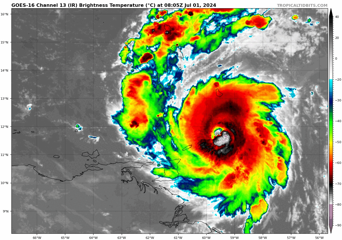
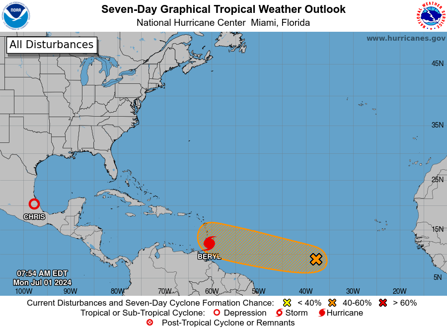
Hurricane Beryl re-intensifying into a Category 4 hurricane as it approaches the Grenadine Islands at 10am AST Monday July 1, 2024. Source: Tropical Tidbits.
Key Headlines:
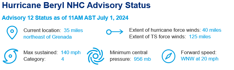
- Major Hurricane Beryl is expected to make landfall along the Windward Islands this morning, Monday, July 1. Hurricane Warnings are in effect for much of the Windward Islands as dangerous, life-threatening conditions are expected. Grenada and the Grenadines are likely to take a direct hit from Beryl today.
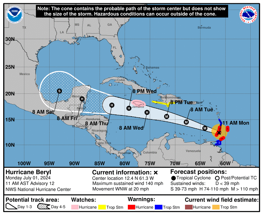
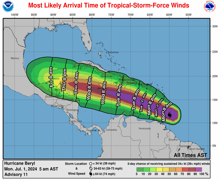
- Following landfall today, Beryl is forecast to move generally west into the Caribbean Sea and maintain hurricane strength. Tropical Storm Watches are in effect across parts of Hispaniola. Currently, Beryl's long-term future is unclear beyond the Western Caribbean. Interests in United States along the Western Gulf Coast should monitor the storm's progress over the course of the week as a precaution.
- Elsewhere in the Atlantic Basin, Tropical Storm Chris formed on Sunday, June 30 in the Bay of Campeche. Chris has since made landfall in Veracruz, Mexico and has been downgraded to tropical depression strength. Chris is expected to dissipate over Mexico’s high terrain today.
Summary:
After forming just a few days ago in the Central Tropical Atlantic, Beryl strengthened quickly, reaching major hurricane strength on Sunday, June 30. While Beryl temporarily lost strength overnight into Monday, it has since restrengthened to category 4 status and is approaching the Windward Islands. Beryl’s intensification was a function of an extremely favorable environment with minimal wind shear and well above average sea surface temperatures.
Life-threatening impacts are expected in the Grenadine Islands and Carriacou Island as Beryl makes landfall, including potentially catastrophic wind damage is expected where the core of Beryl will make landfall. Elevated locations are susceptible to wind speeds even greater than surface winds. Storm surge of 6 to 9 feet is forecast where the eye of Beryl makes landfall, and localized flash flooding can be expected with 3 to 6 inches of rainfall expected through the afternoon.
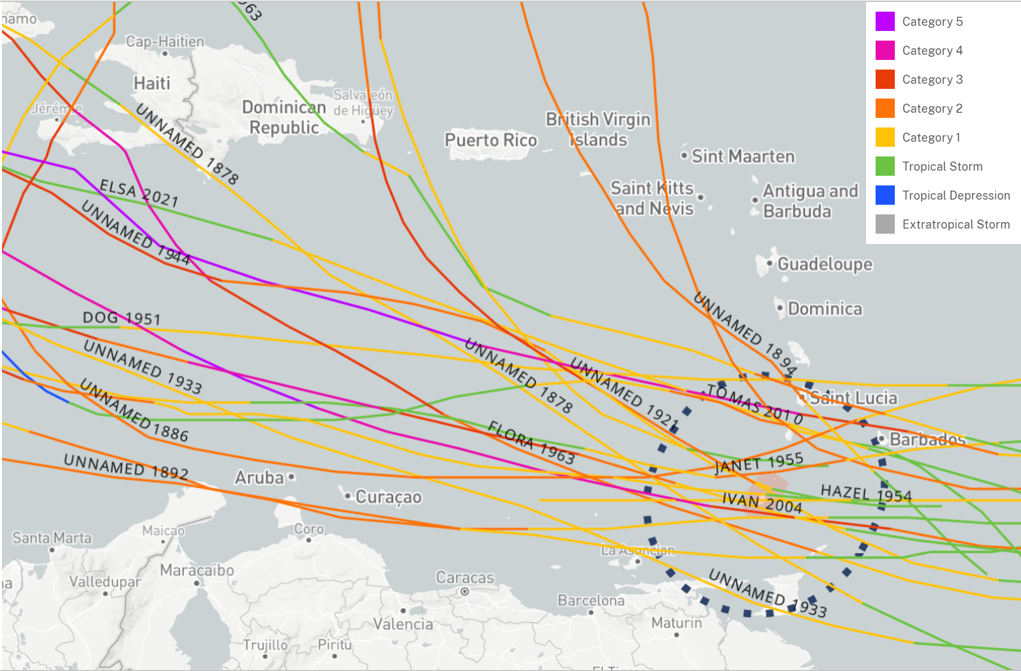
No other category 4 hurricane has tracked within 100 miles of Beryl’s location as of Monday morning. Category 3 Ivan in September of 2004 was the only other major hurricane to do so; the islands being impacted by Beryl have never experienced a hurricane of this strength before.
Off to a Hot Start:
Beryl is the first hurricane in history to become a Category 4 storm in the month of June and is the strongest Caribbean hurricane on record this early in the calendar year. The third named storm of the year – Chris – formed on June 30 off the coast of Mexico and has since made landfall. The average for the third named Atlantic storm is August 3.
Elsewhere in the basin, the National Hurricane Center is monitoring an area of showers and thunderstorms in the central tropical Atlantic, where conditions may allow development throughout the week. Should development occur, the next named storm will be Debby.
Peril Advisory will continue to monitor Beryl. Additional reports will be released as warranted.
Additional links of interest:
Statements from official forecast and emergency management agencies supersede this update, and should be closely followed concerning matters of personal safety.