Key Debby Headlines
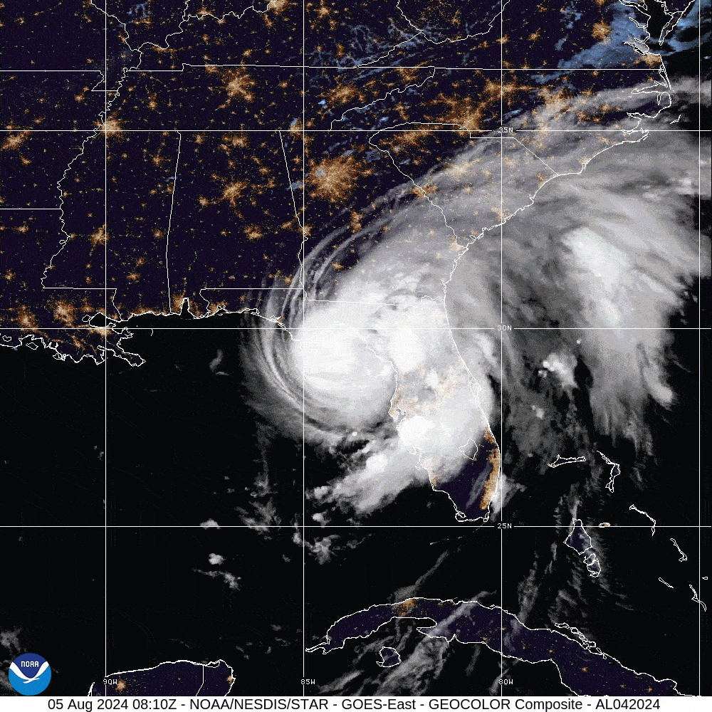
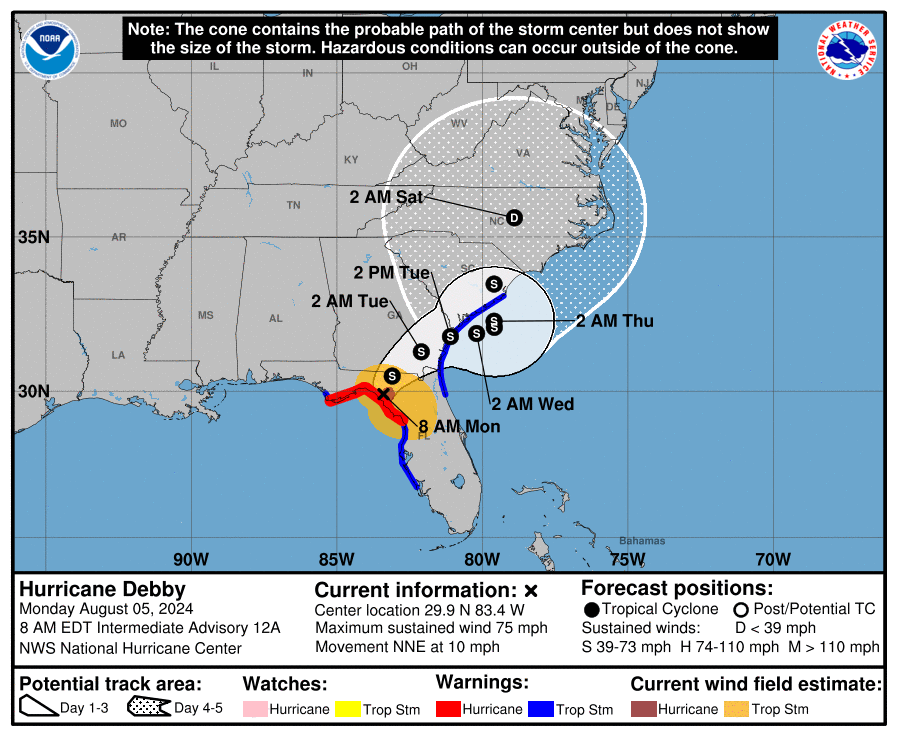
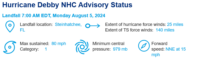
- Landfall: Hurricane Debby made landfall near Steinhatchee, Florida, at around 7:00 a.m. EDT Monday morning, August 5. A category 1 hurricane at the time of landfall packing maximum sustained winds of 80 mph, Debby marks the fourth hurricane to make landfall in August in Florida since 2000 (Charley 2004, Katrina 2005 and Idalia 2023) and came ashore just 15 miles from where Idalia made landfall roughly one year ago.
- Status: As of 8 a.m., Debby still maintains hurricane strength but is expected to weaken as it moves over northern Florida. Maximum sustained winds are currently 75 miles per hour and decreasing.
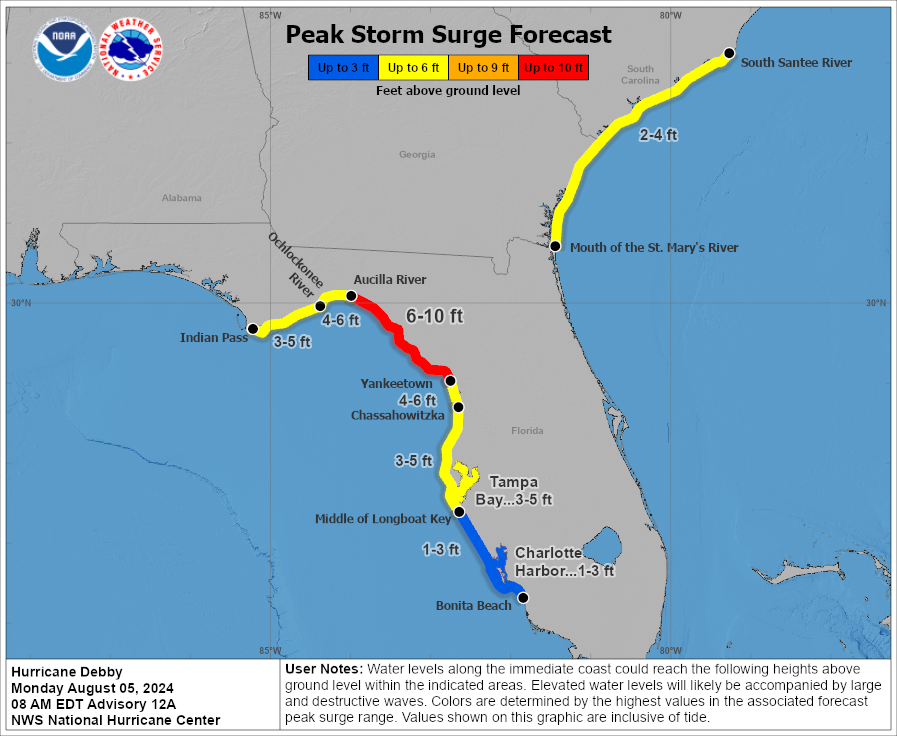
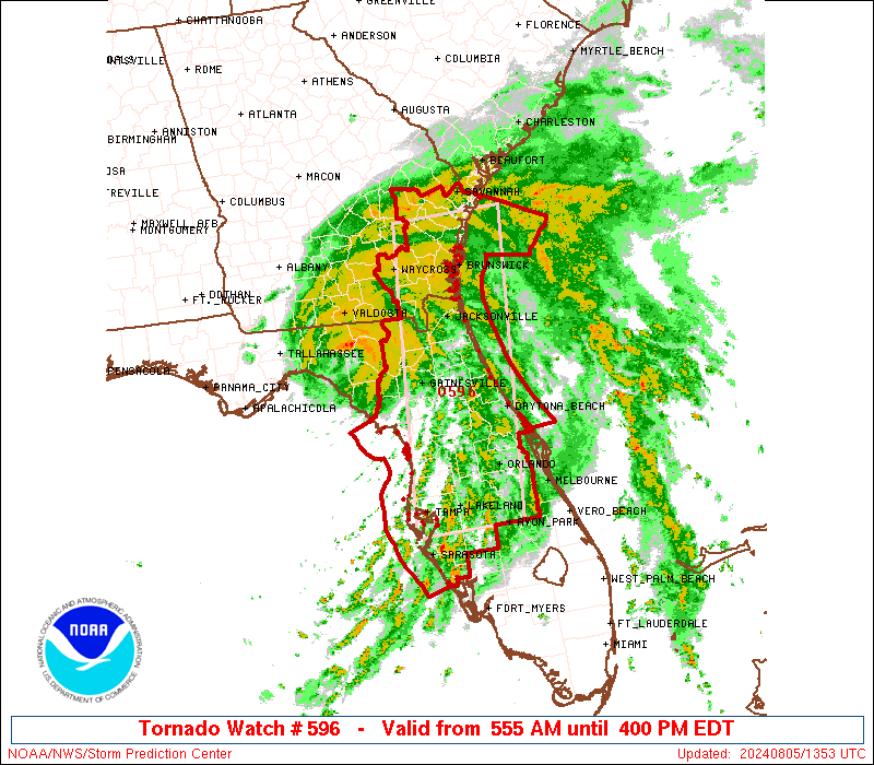
- Ongoing Impacts: Hurricane conditions are ongoing this morning throughout the Florida Big Bend region and will degrade to tropical storm conditions within the next few hours. Surge depths are expected to reach between 6-10 feet in or near Yankeetown, Florida, and throughout the Big Bend region, depending on tidal heights. Additionally, a large portion of northeastern Florida is currently under a Tornado Watch, meaning conditions are favorable for tornadoes and severe thunderstorms. This risk will shift into coastal Georgia by mid-afternoon, and eventually coastal Carolina as well.
- Debby’s Track: Debby will soon slow down and turn more toward the northeast, moving across northern Florida and southeast Georgia today and into tomorrow. Weak steering currents will result in Debby stalling for a few days and likely moving offshore before being pushed back inland over the southeast later this week. Exact track positioning is uncertain, but confidence is high that Debby’s slow motion will lead to significant rainfall and flooding impacts.
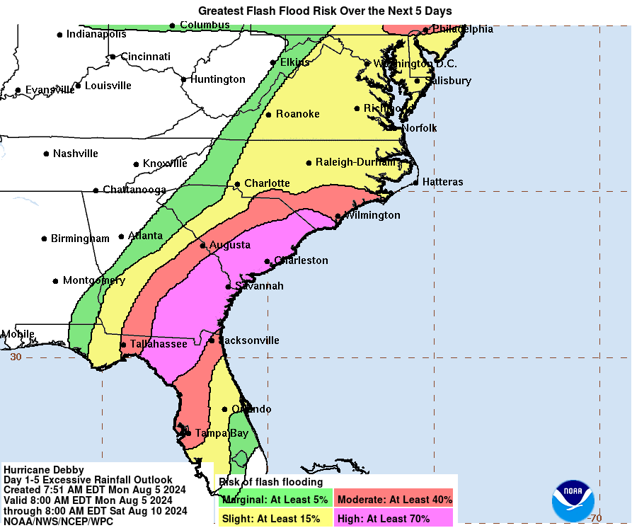
- Significant Flooding Expected: Extreme rainfall across portions of central and northern Florida and much of the southeast United States will likely lead to significant and potentially catastrophic flooding. Details are discussed below.
Debby’s Flooding Threat:
A High Risk (at least 70%) of flash flooding due to excessive rainfall stretches from northeast Florida through southern North Carolina over the next five days. Some areas in Florida have already received over 10 inches of rain ahead of landfall with models suggesting between 6-12 inches more as Debby progresses inland.
Forecasts indicate that Debby could bring historic rainfall to parts of Georgia and South Carolina, with up to 30 inches of rain possible, which could result in Debby breaking the record for the maximum rainfall from a tropical cyclone for the state of Georgia (27.85”; Alberto, 1994) and South Carolina (23.63”; Florence, 2018). Considerable widespread impacts from flash, urban, and riverine flooding are expected throughout impacted areas in these states, as well as southern North Carolina.
Guy Carpenter experts will continue to monitor Debby through the week, particularly with regard to flooding impacts. Additional reports will be issued as warranted.
Additional links of interest:
- US National Hurricane Center
- NOAA Storm Surge Data
- NWS Tampa
- NWS Charleston
- US National Weather Service
- USGS Flood Event Viewer