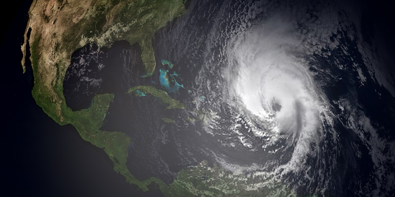


PTC-9 : Northern Gulf
- Current Status: Potential Tropical Cyclone 9 (PTC-9) is now a tropical low over the Northwest Caribbean Sea. The National Hurricane Center (NHC) estimates a 90% chance of development into a tropical storm in the next 48 hours, upon which the system will be named Helene.
- Forecast Track: PTC-9 is expected to slowly lift north through the Yucatan Channel by Wednesday. Upon entering the Gulf of Mexico, the feature will begin to interact with an upper-level system over the Mainland. This interaction should pull PTC-9 to the north-northeast towards the Northeastern Gulf Coast. There is general model agreement that future-Helene will make landfall Thursday afternoon or evening along the Northeast Gulf Coast, but specifics remain uncertain as PTC-9 has yet to form a well-defined center. Ensemble forecasts indicate that landfall may occur anywhere from Alabama to just east of the Florida Big Bend region.
- Intensity: PTC-9 will be moving over unusually warm sea-surface temperatures and also the warm eddy known as the “Loop Current” with the warmest, deepest water in the entire Gulf of Mexico. Reduced wind shear will also enable intensification. One factor that may limit development is the presence of dry air forecast for the Western Gulf. Model guidance has a wide range of intensity scenarios between a major hurricane versus a category 1, and this will evolve as new information comes available from Hurricane Hunter missions scheduled for today and once the storm develops a clear center of circulation. Accounting for these factors, the NHC best forecast has future Helene reaching status as a strong category 2 hurricane prior to landfall on the Northeast Gulf Coast.
- Expected Impacts: Hurricane conditions are growing increasingly likely for the Florida Panhandle, with Hurricane Watches and Warnings likely in the coming days. Given the uncertainty in both track and intensity, interests along the Northeast Gulf Coast should prepare for impacts of a potentially major hurricane, with onset of conditions as early as overnight Wednesday. Coastal flooding due to storm surge is likely, with greatest severity to the right of the track including the Tampa Bay region (even if the track remains west of the area). Inland flooding is also possible due to heavy rainfall as future-Helene tracks through the interior Southeast United States after landfall. Specifics will depend on the exact track and intensity of the storm as forecast confidence improves.
Tropical Storm John : Mexico Pacific Coast
- Current Status: Tropical Storm John is currently located to the southwest of Puerto Escondido, Mexico with maximum sustained winds of 70 mph.
- Rapid Intensification: John is now a strong tropical storm after an unexpected period of rapid intensification, and is now forecast by the NHC to make landfall in the Oaxaca State as a category 2 Hurricane Tuesday evening. Rapid intensification is expected to continue as John is embedded in a moist environment with limited wind shear over warm waters. As such, the NHC has noted that John could strike the region as a major hurricane.
- Uncertain Track: John is moving very slowly in poorly-defined steering currents. Model guidance shows considerable spread. The NHC best forecast has the storm making landfall to the south of Acapulco but specifics remain unclear.
- Expected Impacts: Impacts of a category 2 or major hurricane will bring substantial damage to property and infrastructure, with the most severe effects along and to the right of the track. Seawater inundation due to storm surge will also cause damage to affected properties. Heavy rainfall amounts, amplified by the slow forward motion of the storm, will bring expected rainfall amounts of 10-20 inches with some local amounts of 30 inches to affected areas, and the threat of severe inland flooding. Impacts to more populated areas will depend closely on the exact track of the storm.
- Historical Context: Tropical Storm John is the third storm since 2023 to undergo rapid intensification while approaching the Mexican Pacific coastline, the others being Hurricanes Lidia and Otis from October 2023.


Another statement on these escalating threats is scheduled for tomorrow.
Additional links of interest:
US National Hurricane Center
US National Weather Service