Forecast and Expected Impacts
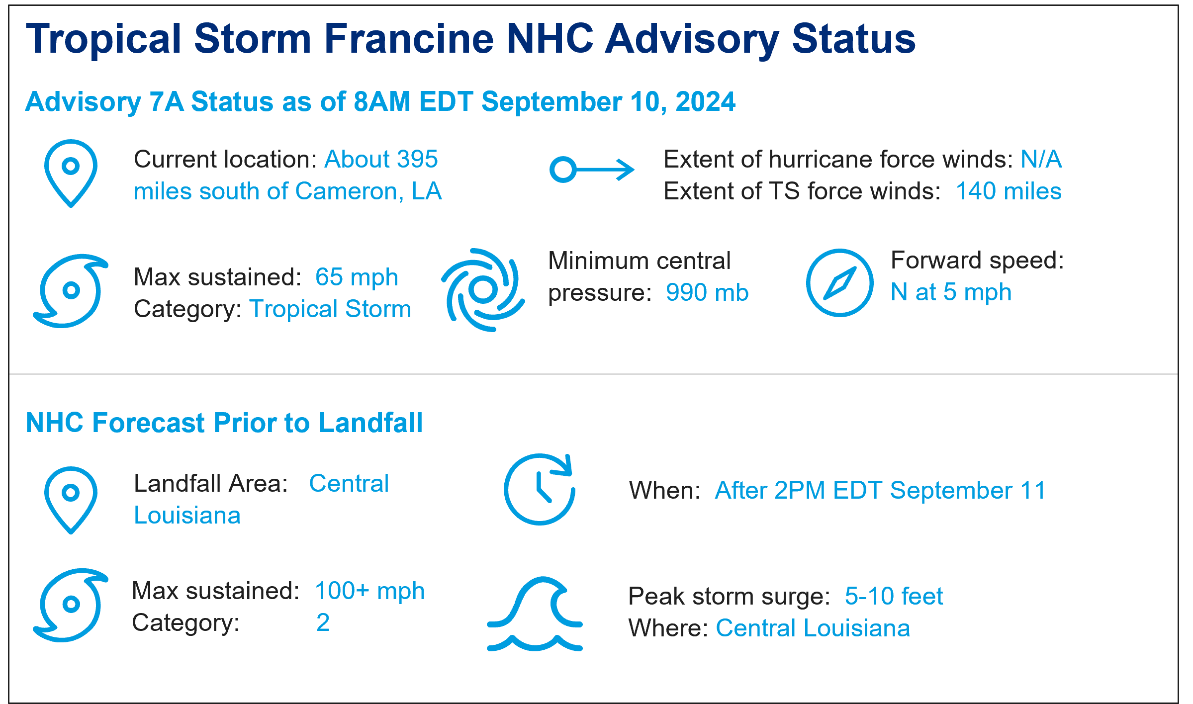
- Intensity: Francine did not become better organized or rapidly intensify last night. This was due to dry air preventing the core from strengthening overnight. Despite this, Francine is expected to strengthen into a Category 1 hurricane by the end of the day over very warm waters and reduced wind shear. After a period of significant strengthening, the storm is expected by the NHC to make landfall as a Category 2.
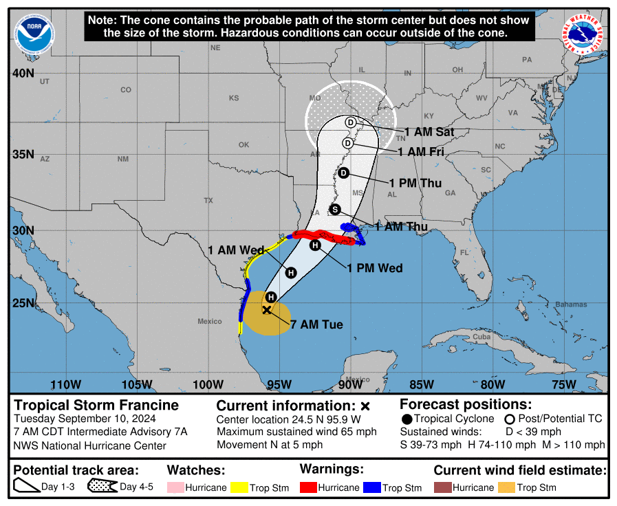
- Track and Landfall: Francine’s track guidance remains similar to the previous update, with landfall expected along Louisiana’s south-central coast. Landfall is expected Wednesday afternoon or evening.
- Rainfall: Francine is expected to bring 4-12 inches of rain throughout Louisiana and Mississippi from Wednesday through Friday morning. Flash and urban flooding is probable as a result, including portions of northeast Mexico and southern Texas through Wednesday as Francine moves through the Gulf.
- Storm Surge: Surge impacts are expected throughout Louisiana, with 5-10 feet expected between Cameron and Port Fourchon, LA and Vermillion Bay. Lake Pontchartrain is expected to see heights of 2-4 feet. Storm surge heights may be on the higher end of the range if landfall coincides with high tide.
- Expected impacts: We should expect light to moderate property damage due to wind along with downed trees and powerlines. Power outages are expected. Seawater inundation due to storm surge will cause property damage along coastal areas and adjacent waterways, with most severe impacts along the coast. Heavy rainfall will cause inland flood impacts, and these effects will be amplified as stormwater management systems are impeded by storm surge.
- Historical Analogues: Since 1970, Louisiana has not seen any Category 2 hurricanes make landfall in the forecasted region of the Athcafalaya Basin. Below is a selection of approximate historical analogues for this storm. Hurricane Danny (1985) was selected as the best historical analogue for Francine, though Francine is forecasted to have somewhat stronger winds on arrival. All of the selected storms had less than USD 1 billion in trended insured losses. The closest Category 2 hurricane to the region was the costly Hurricane Sally (2020), which made landfall in Alabama affecting a more densely populated region.
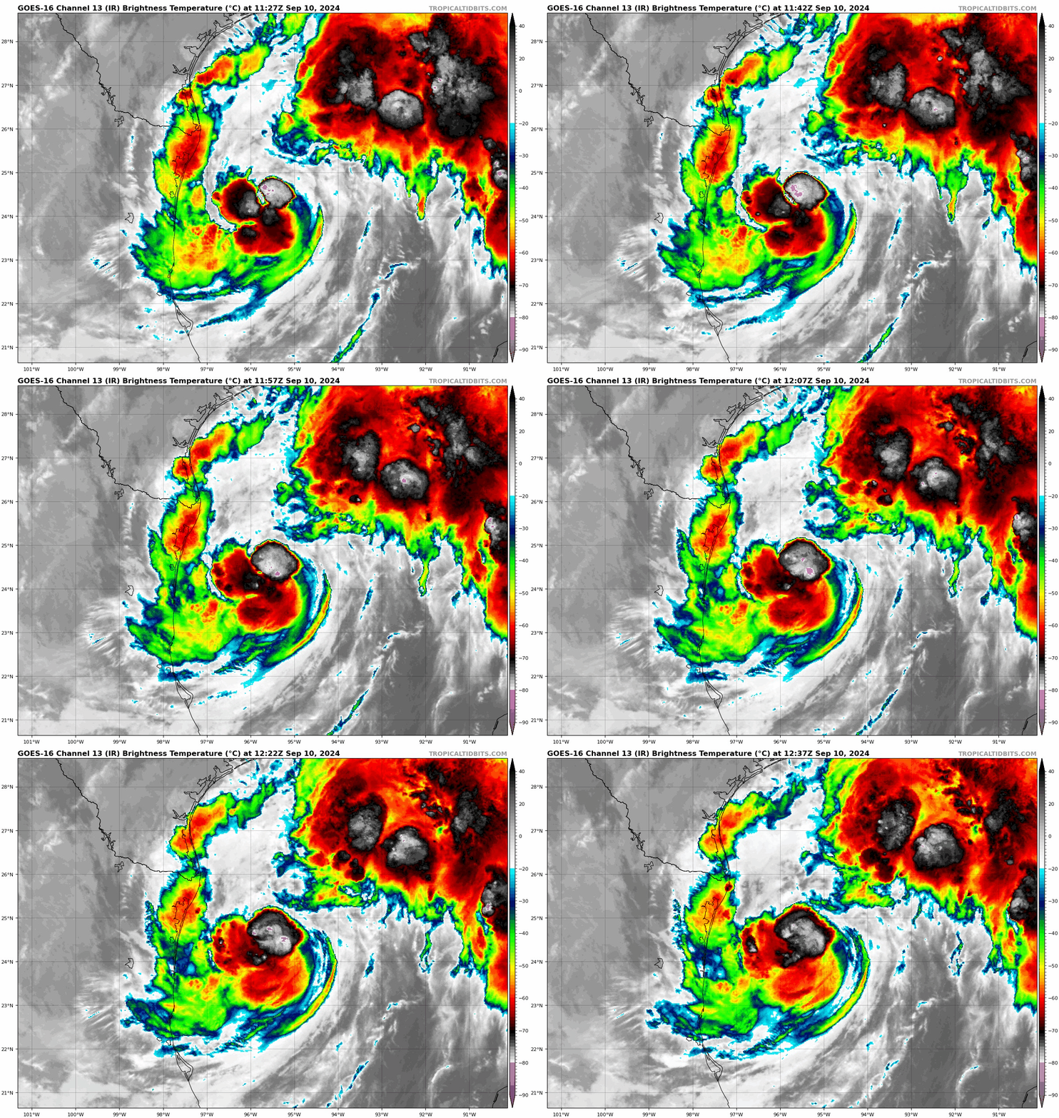
Satellite Loop (Infrared). Note less organized state. Source: TropicalTidbits.
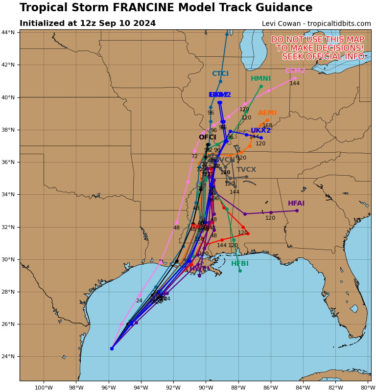 Model Forecast Track Scenarios. Note clustered solution for Southern Louisiana. Source: TropicalTidbits
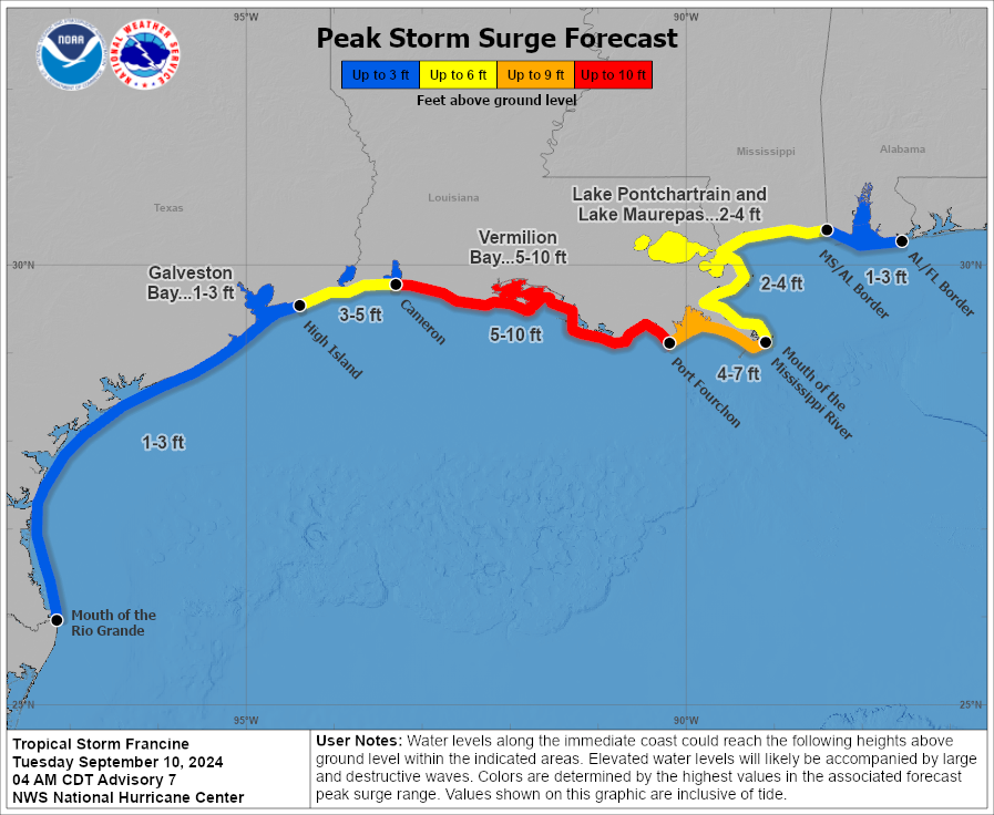 Storm Surge Forecast. Source: NOAA/NHC.
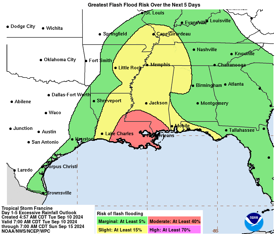 Excessive Rainfall Outlook and Flash Flood Potential. Source: NOAA/NHC.
 Historical Hurricanes Since 1970 Affecting a Similar Area Source: NOAA.
Additional links of interest:
US National Hurricane Center
US National Weather Service
Statements from official forecast and emergency management agencies supersede this article and should be closely heeded concerning matters of personal safety.
