Francine Headlines
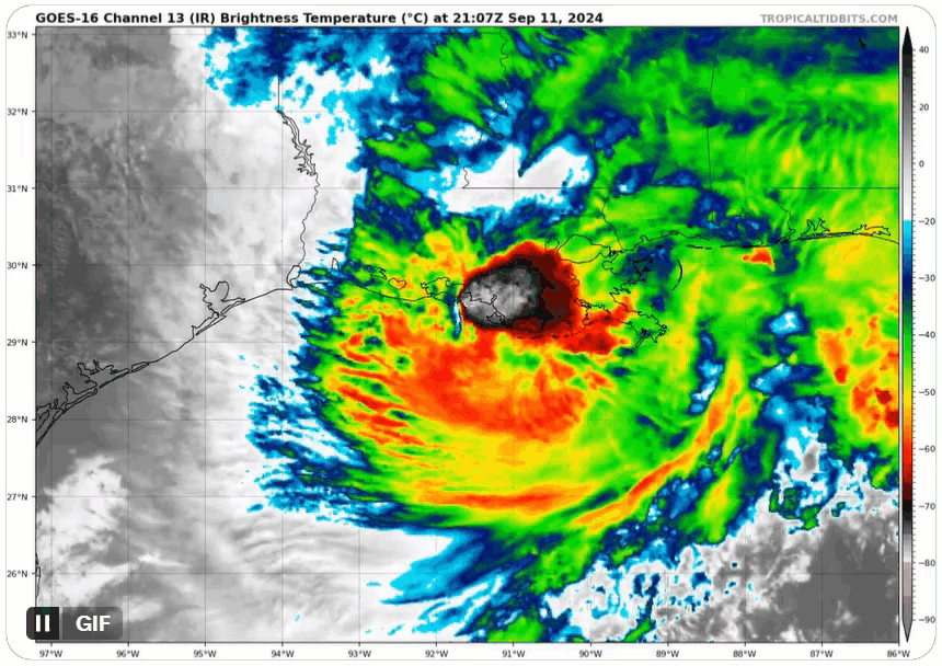
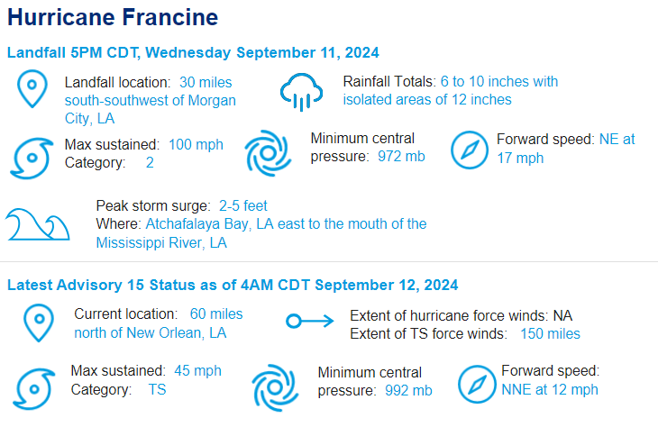
- Rapid Intensification Prior to Landfall: As atmospheric shear decreased on Tuesday, Francine tracked over well above average sea surface temperatures in the northwestern Gulf of Mexico, intensifying by 35 mph in 24 hours prior to landfall. Rapid intensification within 24 hours of US landfall has happened 7 times since 2017 and only 8 additional times back to 1982.. The highest onshore wind report occurred at Eugene Island, LA with a peak wind gust of 105 mph and storm surge of 5 feet.
- Eighth Category 2+ Louisiana Landfall Since 2000: Francine joins Delta (2020) and Gustav (2008) as category 2 landfalls on the Louisiana coastline this century, along with three category 3 and two category 4 landfalls. From a track perspective, slightly stronger category 3 landfall Zeta (2020) is closest to the landfall of Francine. Delta, Gustav and Zeta would produce between USD $2B to $3B of insured loss if they transpired today.
- Wind Damage: Initial reports highlight wind damage to vulnerable building classes such as light metal structures, older residential homes and coastal commercial risks as well as tree fall damage to structures. As of late Wednesday evening, 311,000 customers were without power in Louisiana, roughly 15% of the state. Local power company Entergy estimates the most heavily impacted areas, near Houma, LA, will take up to 10 days for full restoration.
- Flood Damage: The largest concern with Francine surrounds heavy rainfall in the New Orleans metro region. Last night widespread rainfall amounts of 6-8 inches were recorded. 90 of the 99 drainage pumps in the New Orleans Hurricane and Storm Surge Damage Risk Reduction System were operational at landfall. Current pumping capacity is capable of evacuating 1 inch of rainfall in the first hour and a half inch an hour thereafter. A flash flood emergency was issued Wednesday night for the region; fortunately no further rain is expected on the backside of Francine with flood waters receding Thursday. Coastal flooding from storm surge has transpired from the central Louisiana coastline eastward to Mobile Bay, AL with some inundation of low-lying coastal structures.
- Inland Impacts: Inland rainfall is expected to cause rivers in southern Louisiana and Mississippi to reach moderate and in some instances major flood stage today and tomorrow, most specifically on the north side of Lake Ponchartrain. A tornado watch is in effect for the Gulf Coast region from Louisiana east to the Florida panhandle. Further inland, Francine is expected to dissipate by tomorrow over the southern Mississippi River Valley.
- Statistics with Francine: The US coastline has now had eight consecutive seasons of a category 2 or higher hurricane landfall, dating back to 2017. Along with Beryl and Debby so far this season, three landfalling US hurricanes by September 11th is a relatively rare occurrence. Eight years since 1900 have seen this level of early season US landfall frequency, most recently in 2020, 2005 and 2004. However, overall activity to date in the basin is at the 30-year average measured by Accumulated Cyclone Energy, below average in named storm days and slightly above average in major hurricane days.
- Behind Francine: Tropical Depression #7 is in the eastern Atlantic and is expected to become Tropical Storm Gordon today or tomorrow. Gordon will stay at sea and is no threat to land. Two other disturbances in the deep tropics are unlikely to form in the next seven days. Thus, after Francine, the middle third of September looks to remain relatively quiet with no landfall threats.
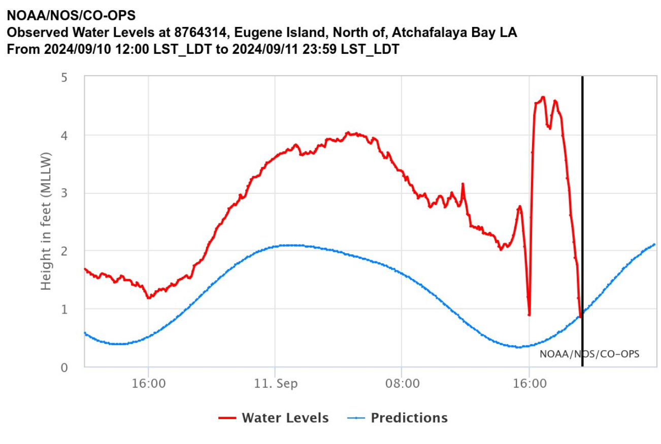
Expected versus actual water height at Eugene Island, LA, which recorded a peak wind gust of 105 mph. The significant decline in water levels at the end of the graph is due to the eye passing over the island and the wind direction rapidly pushing water out to sea. Source: NOAA/NOS.
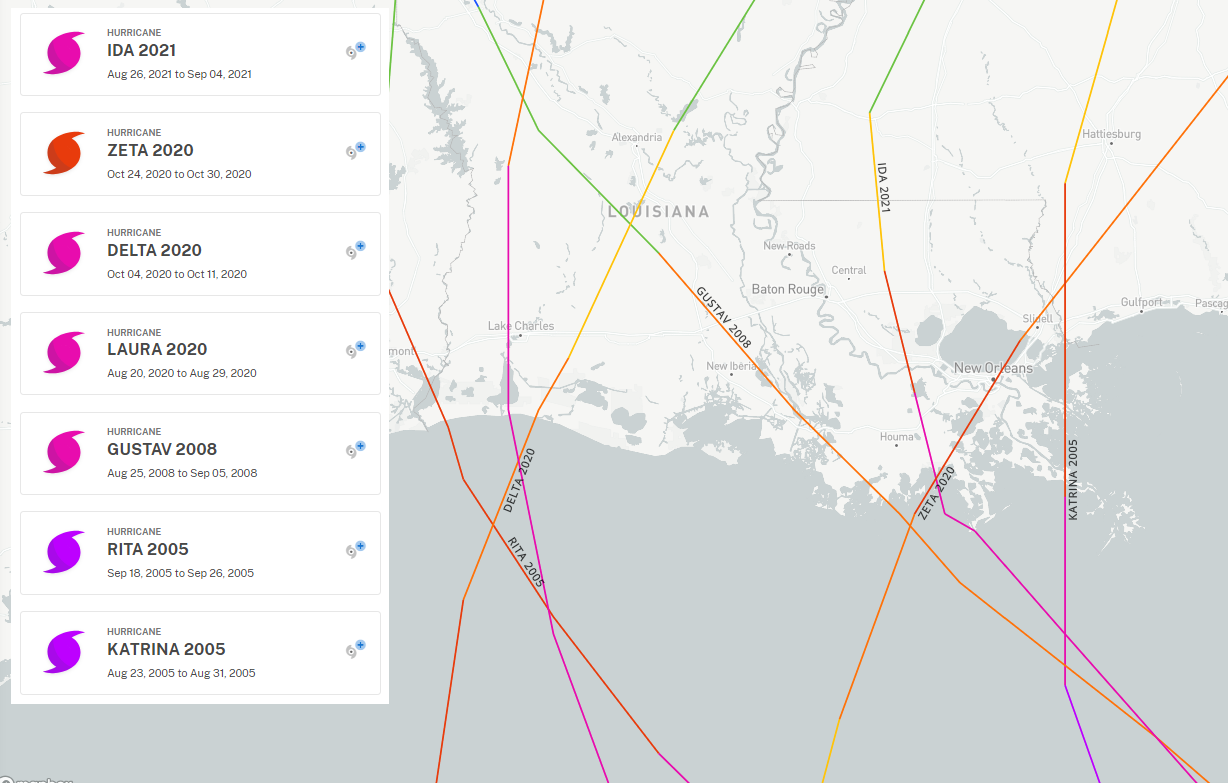
Historical category 2 or higher landfalling hurricanes in Louisiana since 2000. Source: NOAA.
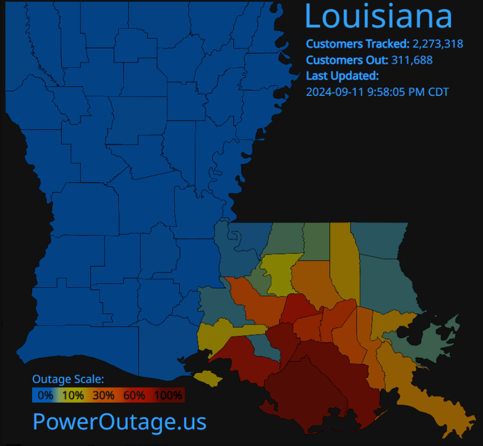
Power outages in the Entergy operating area as of the evening of landfall. Source: Entergy, PowerOutage.us.
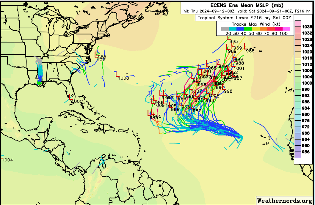
European ensemble low pressure track forecast through mid-September; only Gordon in the central Atlantic is forecast to become a named storm which will stay out at sea. Source: Weathernerds.org.
This is the last report planned for Hurricane Francine.