

Summary
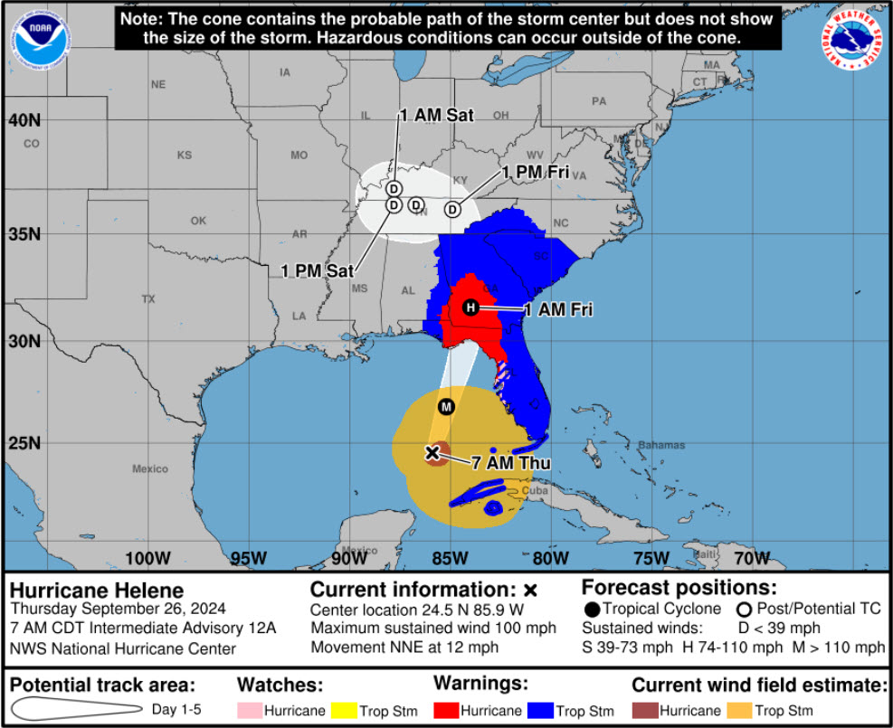
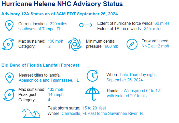
- Current Status: Per the September 26 8 a.m. EST advisory from the National Hurricane Center (NHC), Hurricane Helene is a category 2 hurricane with maximum sustained winds of 100 mph. The center of circulation is located 365 miles south of Apalachicola, Florida, on the Florida Panhandle. Helene is a very large storm with Tropical Storm force winds extending 345 miles from the center. There have only been 4 named storms in the 21st century over the Gulf of Mexico that have reached the same size of tropical storm force winds as Helene: Irma (2017), Ike (2008), Ivan (2004), and Isidore (2002).
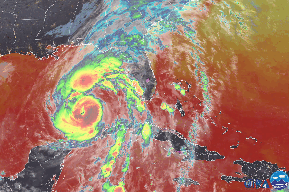
- Forecast Track: Helene continues to steadily intensify over the warm and deep waters of the Gulf of Mexico. Some dry air and structural issues within the inner core have prevented rapid intensification to this point, but a major hurricane (category 3 or higher) landfall continues to be likely late Thursday evening. The NHC is explicitly forecasting significant intensification before landfall. Regardless of Helene’s peak intensity, the large size of the hurricane will generate substantial wind and surge impacts across the Eastern Gulf. As Helene interacts with a frontal system located over the Central Mississippi Valley, the forward speed of Helene will accelerate through landfall. Helene’s eye remains on track to make landfall in Franklin County, Florida, near Appalachee Bay, with the worst wind and surge impacts to the right of the center.
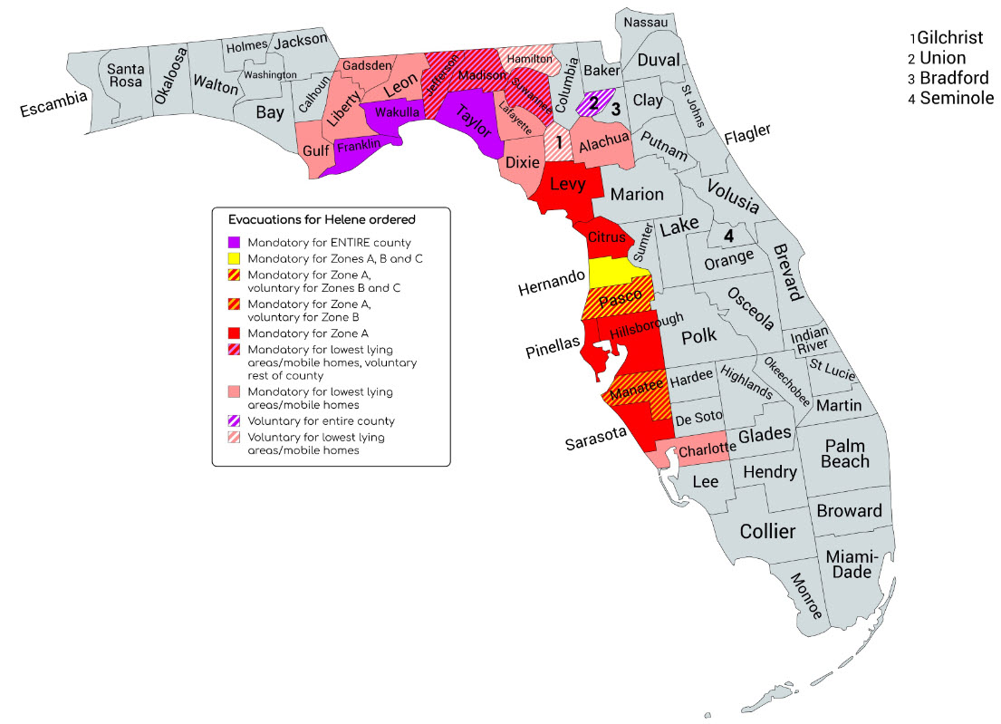
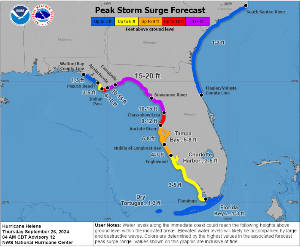
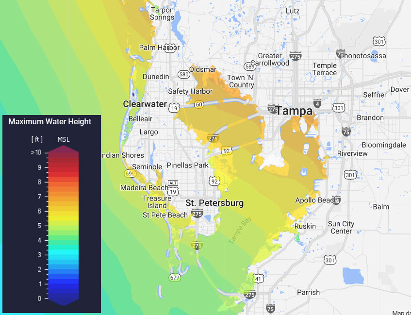
- Across the Florida Big Bend region, a destructive storm surge of 15-20 feet is possible, inundating coastal structures and infrastructure. The unusually large breadth of winds will result in 5-8 feet of storm surge for both Tampa and St Petersburg. Surge levels will be potentially the highest observed in Tampa Bay in at least 75 years. This level of surge in the Tampa Bay area will result in significant inundation and damage to coastal structures.
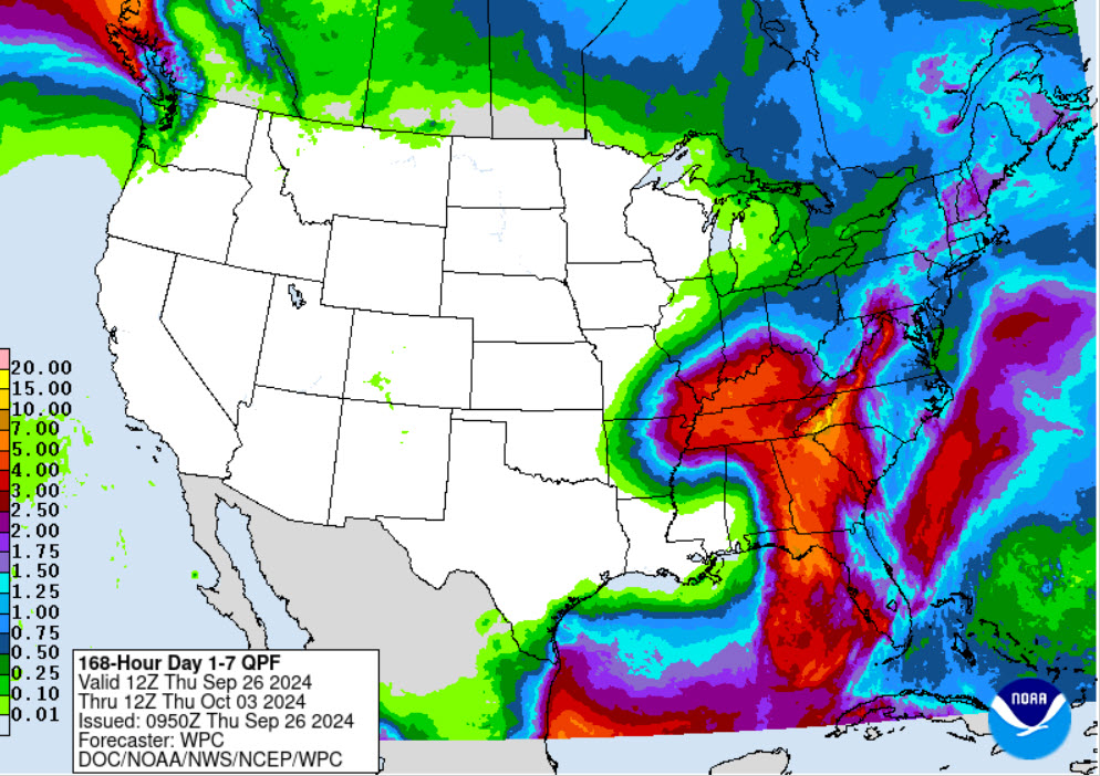
- Post-Landfall Track and Impacts: After landfall, the hurricane will bring significant impacts to Tallahassee, FL as the eyewall is forecast to move directly over the city. If Helene shifts slightly east, this dangerous part of the storm may move just east of Tallahassee, reducing the extent of damage. As Helene moves further inland, the decay of winds is expected to be lower than average due to the quick forward speed and frontal interaction. Helene is expected to bring sustained tropical storm winds and hurricane force gusts as far inland as Atlanta; this is the sixth year of the last decade Atlanta has been under tropical storm warnings. Helene’s impacts will potentially be more acute than previous tropical storms due to its quick forward speed helping the storm maintain a higher intensity. Helene’s tropical moisture will interact with the Southern Appalachians as well, delivering terrain enhanced rainfall and flooding in these zones. In the coming days, Helene will weaken while inland and meander across Tennessee and Kentucky, leading to flooding concerns in the region.
Another statement will be issued on Helene tomorrow morning (September 27) after the hurricane makes landfall late this evening.
Additional links of interest:
US National Hurricane Center
US National Weather Service
US National Weather Service Local Office Statements
Southeast Regional River Forecast Center
Coastal Storm Surge Reports
NOAA Updates on Hurricane Helene