

Forecast and Expected Impacts
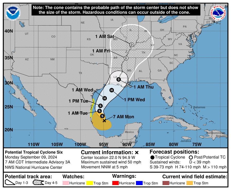
- Current Status: In the western Gulf of Mexico, Potential Tropical Cyclone 6 was identified by the National Hurricane Center (NHC) yesterday evening. The feature is now producing maximum sustained winds of 50 mph with signs of organization, although it has yet to develop a closed circulation.
- Forecast Track: The feature is expected to curve to the north over the coming days on the western side of a subtropical ridge, before accelerating to the northeast late Tuesday as it interacts with another weather system crossing the mainland. Model guidance is in close agreement on the general scenario. Accounting for these factors, the NHC best forecast takes the feature into the Northern Gulf Coast Wednesday afternoon, most likely over the Atchafalaya Basin in Louisiana. Following landfall, the storm should weaken and move into the Central Mississippi River Valley.
- Intensity: The feature is expected by the NHC to develop into a Tropical Storm today (Francine) once it develops a closed circulation. The feature will be moving over warm waters with marginal wind shear and a moist environment, which should lend to steady intensification over the next 48 hours. While approaching the Northern Gulf Coast, the feature should encounter increasing shear and perhaps dry air to offset strengthening. The timing and influence of these factors are difficult to anticipate especially since the feature has yet to develop a closed circulation. Model guidance has the feature moving inland as a category-1 or perhaps as a category-2 hurricane. Accounting for these factors, the NHC best forecast takes the feature into the Northern Gulf Coast as a mid-range category-1 hurricane Wednesday afternoon.
- Wind Impacts: Hurricane conditions are increasingly likely for portions of the Northern Gulf Coast, and hurricane watches and warnings are expected with coming NHC forecast cycles. Tropical storm conditions are also probable along portions of northwest Mexico and southern Texas and a tropical storm watch is now active. Light to moderate property damage due to wind can be expected near and to the right of the track, with lower-grade impacts well away from the center of circulation along with downed trees and powerlines.
- Storm Surge: Coastal flooding due to storm surge is likely to affect the Northern Gulf Coast, with greatest severity along and to the right of the track. Property and infrastructure damage due to seawater inundation can be expected for affected coastal areas and adjacent waterways, with more severe damage due to wave battering for immediate coastal areas. Storm surge watches and warnings are likely for the Northern Gulf Coast with coming NHC forecast cycles.
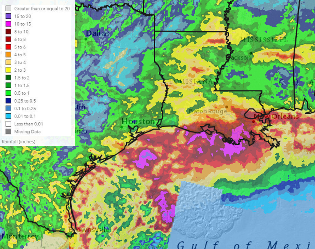
- Inland Flooding: Heavy rainfall will produce inland flooding and flash flooding with resulting property damage due to inundation and water velocity. Some areas under threat in Southeast Louisiana have saturated soils from recent rainfall events which may amplify these effects. Heavy rainfall should affect the Southern and Central Mississippi Valley as the storm weakens and moves inland after Wednesday.


Additional links of interest:
U.S. National Hurricane Center
U.S. National Weather Service
Statements from official forecast and emergency management agencies supersede this article and should be closely heeded concerning matters of personal safety.