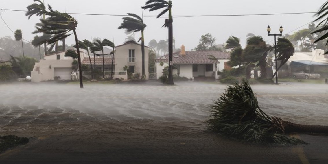
Hurricane Milton Implications

Source: National Weather Service

Below is a live update on Hurricane Milton's impending Florida landfall. Our full report, which is available here, compares Milton to Hurricane Ian (2022) as well as other infamous 21st century Florida west coast hurricanes including Charley (2004) and Irma (2017). Today’s report provides a comparison of Milton to these hurricanes, discusses the ramification of evacuations, reviews mitigation and resiliency efforts to fortify Florida electricity infrastructure, and highlights lessons learned in the Guy Carpenter damage survey of Ian conducted in late 2002.
Summary
- Current Status: As of 2 p.m. EST on October 9, 2024, Hurricane Milton remains a Category 4 hurricane with maximum sustained winds of 130 miles per hour. Milton has gradually weakened thanks to a combination of an eyewall replacement cycle, increased wind shear, and dry air in the vicinity of the storm. The National Hurricane Center (NHC) confirms that Milton’s wind field has been quickly expanded—as of 2 p.m. EST tropical- storm-force winds extend 250 miles from the center and hurricane force winds extend 35 miles from the center. Milton’s eye is located about 150 miles southwest of Tampa, Florida, and Milton is moving north-northeast at 16 mph.
- Current Impacts: While Milton remains approximately 12 hours from landfall, the hurricane is already impacting Florida. Heavy rainfall is blanketing western Florida, with stronger bands closer to Milton’s core impacting Collier, Lee, Sarasota, and Manatee counties. This band of heavy wind and rain is moving into the Tampa Bay metro as of 2 p.m. EST. A tornado outbreak is underway throughout central Florida, with several tornado warnings active across the region. Isolated supercells near Lake Okeechobee have developed several strong tornadoes, while a strong band in west-central Florida coast triggered three simultaneous tornado warnings just outside Fort Myers. Additionally, tidal levels are beginning to rise quickly between Sarasota to Naples as Milton approaches land. As of 230 EDT, Naples has the highest surge reading of just over 3 feet and water levels are sharply rising along the west-central Florida coast.
- Forecast Track: Over the last 6 hours, Milton has started to move slightly more north than northeast towards the west-central Florida coast. Consensus is building in the model guidance that the most likely landfall location is either in Manatee or Sarasota County, Florida. Bradenton Beach to Venice, Florida continues to be the most likely crossing point and nearly all model guidance has moved south of Tampa Bay. This is a notable update as the chance of major storm surge flooding in Tampa Bay and Pinellas County has dropped significantly. The NHC expects Milton to make landfall just after midnight on Thursday with hurricane conditions beginning before nightfall. While confidence is increasing in the track of the storm, it is important to note that track error 12 hours out from landfall is approximately 35 miles. After Milton makes landfall, it will then traverse east-northeast across the Florida Peninsula, before emerging into the Atlantic Ocean on Thursday afternoon.
- Intensity Forecast: The National Hurricane Center has decreased Milton’s anticipated landfall intensity to a high-end Category 3 but has not ruled out the possibility of Category 4 status. Despite weakening maximum sustained winds, Milton will continue to grow in size, amplifying potential storm surge and precipitation impacts due to an expanding wind footprint. A slow decay in the winds is expected after landfall, and Milton is anticipated to move off the east coast of Florida on Thursday still as a hurricane. Thus, surge and wind impacts will extend to the northeast Florida coast late Thursday into Friday with the most significant surge and wind impacts between Melbourne and Jacksonville.
Headline Impacts
- Wind: The forecasted landfall intensity of Milton is between 100-120 knots (~115-135 mph). Maximum recorded gusts could exceed 155 mph at coastal locations. The southeast portion of the storm contains the strongest winds.
- Storm Surge: The forecasted maximum storm surge of Milton is 10-15 feet and the location of peak surge is currently forecasted for the Florida coastline between Sarasota and Port Charlotte (the region southeast of Milton’s forecasted landfall location). Coastal communities in Sarasota, Charlotte, and Lee counties should prepare for peak storm surge impacts from Milton.
- Rainfall: Milton is forecasted to drop 15+ inches of rain locally in less than 24 hours. The highest totals are forecasted to occur in the regions just northeast of the center of Milton during its traverse across Florida. Forecasts suggest that Pinellas, Hillsborough, and Pasco counties will likely avoid large storm surge impacts but are expected to experience the worst precipitation-related flooding.
For a more in-depth report on Hurricane Milton's impending landfall in Florida, click here.

October 9 mid-day satellite loop for Hurricane Milton. Source: Levi Cowan, TropicalTidbits.com
 Most likely arrival time (contours) and probability (shaded) of tropical storm force winds. Source: NOAA/NHC.
 October 9 mid-day Tampa Bay radar loop. Note the tornado warnings (red boxes) over south-central Florida. Source: Brian McNoldy, University of Miami.
 October 9 12z model track guidance. Source: Dr. Brian Tang, University at Albany.
 October 9 12z model intensity guidance. Source: Dr. Brian Tang, University at Albany.
 October 9 Observed Water Levels at Naples Bay, Florida. Source: NOAA
Another update from the CAT Resource Center will be released on Milton tomorrow morning after landfall has occurred.
Additional links of interest:
U.S. National Hurricane Center
U.S. National Weather Service
National Weather Service Tampa
National Weather Service Radar Loop
National Weather Service Local Statements
Tide Gauges
Florida Department of Emergence Management