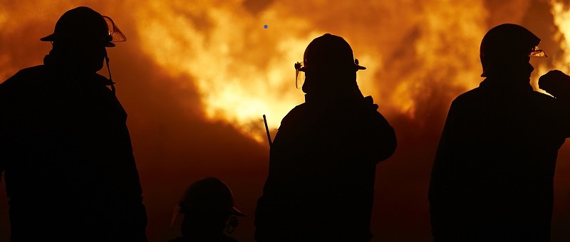

Southern California is facing a severe wildfire crisis as of Monday morning, January 13, 2025. At least 24 people have died, with more than a dozen missing. The Palisades Fire (23,713 acres, 13% contained) and Eaton Fire (14,117 acres, 27% contained) are the largest blazes, destroying thousands of structures and forcing more than 150,000 people to evacuate. Strong Santa Ana winds are expected to intensify through Wednesday, worsening fire conditions, despite the efforts of more than 14,000 personnel and prepositioned resources.
Current Fire Situation
Firefighters made significant progress on the Palisades Fire on Sunday, which was on the verge of moving east into heavily populated Brentwood and north into the communities of the San Fernando Valley, most specifically Encino. As of Sunday evening, CalFire indicated that unburned islands are still present within the fire footprint that pose a threat to established containment lines as the winds pick up.

Los Angeles County is beginning to perform detailed damage assessments at the property level, showing structures categorized by their level of damage. These assessments are ongoing, and updates are provided on a daily basis as new data is collected.

Similarly, firefighters on the Eaton Fire worked through Sunday on constructing and improving containment lines, as well as performing damage assessments. Stronger winds tonight are expected to increase fire activity in pockets of unburned vegetation or residual heat in burned structures.


Current Impacts
As of Monday morning, more than 150,000 people have evacuated due to the currently burning wildfires, and approximately 50,000 customers remain without power. Many others are on standby for possible evacuation including the UCLA campus.
However, Edison International has warned that as the Santa Ana winds return, power may be shut off to keep utility lines from sparking, possibly impacting up to 450,000 customers. The death toll has reached 24, with 8 from the Palisades fire and 16 from the Eaton fire; the latter is now among the deadliest fires in California's history.
Air quality remains impacted by wildfire smoke across Los Angeles, with AirNow reporting Moderate levels of PM2.5 particle pollution. While this is an improvement from dangerous levels of pollution reported last week, sensitive populations may still be impacted. Winds are expected to provide some air quality relief as the day progresses.

Water resources remain stretched. The US National Weather Service models indicate only a 25% chance for measurable precipitation within the next week, and less than a 10% chance of significant precipitation.
Last week, it was additionally reported that fire hydrants in Pacific Palisades began running dry. As demand spiked to aid firefighting efforts, water was pulled from holding tanks. This, alongside some breaks in water mains due to the fire spreading, reduced pressure throughout the system and caused many hydrants to temporarily run out of water. Reservoir capacity remains sufficient, and there is no reported shortage of water within the municipal systems. California Governor Gavin Newsom has called for an independent investigation into the fire hydrants running dry.
Upcoming Santa Ana Wind Event
A Red Flag Warning, noting a “Particularly Dangerous Situation” will be active from late Monday night through Wednesday morning for areas under threat in Southern California, according to the US National Weather Service (NWS).
Strong Santa Ana winds, with gusts up to 70 mph, combined with low humidity, will enable extreme fire behavior, rapid spread, and long-range spotting through Wednesday. These wind conditions will be driven between a high-pressure area over the Great Basin and another area of low pressure near the coast. These conditions could hinder firefighting efforts, increase evacuation coverage, and threaten more structures.

What are the Santa Ana Winds?
- According to the National Weather Service (NWS), Santa Ana winds occur when air from a high-pressure region over dry, desert areas, often the Great Basin, flows westward toward low pressure near the California Coast.
- This movement creates dry winds that generally flow from east to west through mountain passages in Southern California, including the Santa Ana Canyon.
- As the air descends from higher elevations of the interior to lower elevations near the coast, it becomes compressed, causing temperatures to rise, similar to an air compressor in an auto shop.
- These winds can cause property damage due to their force and significantly amplify the threat of wildfire spread. Santa Ana winds typically occur during the cool season, from September through May.

To prepare for the return of Santa Ana winds, authorities in Southern California have implemented several measures:
- Strategic Resource Deployment: Fire crews, engines, helicopters, and bulldozers have been prepositioned near high-risk areas, including the Palisades Fire zone.
- Fire Retardant Drops: Aircraft are applying fire retardants along hillsides to create containment barriers.
- Evacuation and Alerts: Officials are urging residents to heed evacuation orders and stay informed through multiple notification systems.
- Federal Support: FEMA has authorized federal resources to aid firefighting efforts.
For the longer term, an onshore flow may briefly develop for Friday and Saturday with increased humidities and cooler temperatures as a disturbance crosses the area. This should allow greater headway with containment efforts. An offshore flow could redevelop into next week as high pressure redevelops over the interior per the NWS.
Sources: AirNow, Cal Fire, U.S. National Weather Service. U.S. Storm Prediction Center.
Additional links of interest:
National Interagency Fire Center
SPC Fire Weather Outlook
CalFire
NWS Los Angeles